The North Atlantic Arc Home
October 5 6 7 8 9
 |
|
Wednesday 6
October 1999 We left Reykjavík at about 9:00, through the tunnel under the fjord to the north of town. We stopped for gas in the suburbs and shortly found ourselves in the wilds of Iceland. In the middle of a lava field, a sign-posted trail led up to the rim of a volcanic crater called Grábrók. Two other cratered cones stood nearby. At about noon we pulled into the town of Hvammstangi to visit the post office and the bank, and to have lunch. There was one restaurant in town, with precisely one menu item available---fish and chips, virtually identical to last night’s dinner. We were the only customers. I gather that Icelanders don’t go out much during the week. Off we went in pursuit of Hvítserkur, a sea stack shaped like a great grazing buffalo (a petrified troll in the Icelandic imagination), which my guidebook led us to believe was a few miles up the road from Hvammstangi. The pavement ended just outside town, but the dirt road was well maintained. A few miles farther than we’d thought the mighty buffalo would be, a sea stack jutted up above the coastal bluff. We made our way laboriously down to it; it wasn’t Hvítserkur. Another few miles on, the road deteriorated considerably. It became apparent that a major reconstruction project was going on. At points the undercarriage dragged on the loose sand and rocks, and we feared getting stuck. Before long we were entertaining thoughts of being stranded at the end of the earth. Finally, we came upon the construction workers responsible for the mess. I showed one the picture of Hvítserkur in the guidebook and asked him how far. He showed me varying numbers of fingers and said “ten”, then “fifteen”, then “eight”. In retrospect, I think I was supposed to multiply these. At least the crew hadn’t gotten around to destroying the road beyond that. Around the tip of the peninsula we drove. Suddenly, Win found the beast on the map; we’d never spotted it because it was on the opposite side of the peninsula from where we’d thought it would be. Finally, we arrived at the sign-posted trail, and cursed the errant buffalo all the way down. But Hvítserkur itself was pretty spectacular, and the sun smiled on us as we took pictures. A short time later, the road climbed up the shoulder of a high knoll, and we stood at the foot of Borgarvirki. In a horseshoe of hexagonal basalt columns, Vikings had built, some 900 years ago, several buildings and a well, all now in tumbled ruins. They fortified the gaps in the crater wall. The site dominates the valley, with magnificent views of mountains to the east and west and the fjord to the north. We lingered despite the strong cold wind, enchanted by the mystery of this place. It was late afternoon by this time, and it was apparent that we were going to be quite late into Akureyri. We had two hours yet to drive, so we drove hard and fast the rest of the way. We crossed the head of another fjord, Skagafjörður, just after sunset and drove up into a pass in the snow-peaked mountains in the eerie blue twilight. We arrived in Akureyri at about 8:00, found a room and dinner, and now sit in a kaffi (café) sipping seven-dollar Guinnesses served by the blond and beautiful Birna. Next |
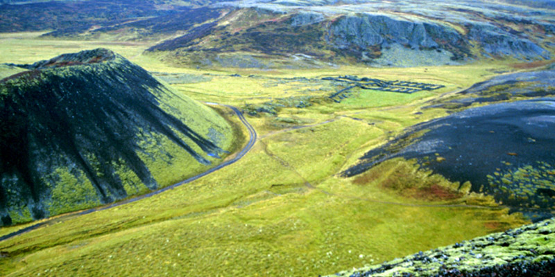 |
Cinder cones and sheep pens.
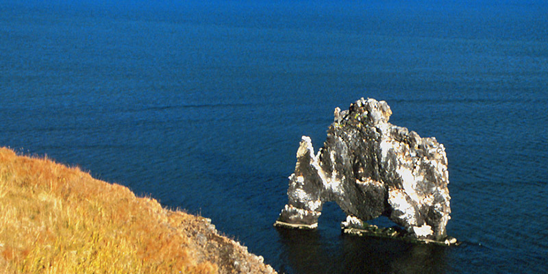 |
Hvítserkur.
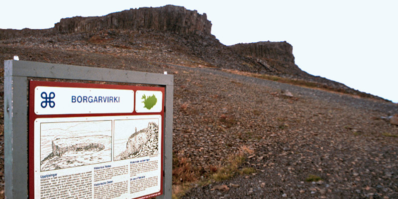 |
Borgarvirki.
 |
The view northeast from Borgarvirki.
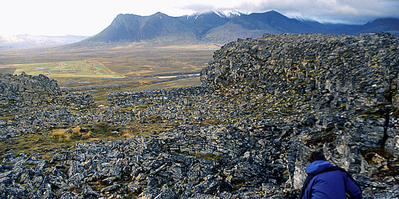 |
The eastward view from Borgarvirki.
 |
A lonely fisherman's shack.
Next
The North Atlantic Arc Home
Mr Tattie Heid's Mileage
Results may vary