The North Atlantic Arc Home
October 5 6 7 8 9
 |
|
Thursday 7 October 1999
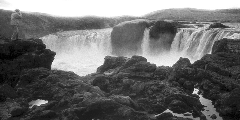
We left late this morning, slowed by last night’s beer. Our first destination was Goðafoss, a graceful thirty-foot waterfall. The legend is that a Viking chieftain, returning from a meeting at Þingvellir where it was decided that all Iceland would convert to Christianity, threw his pagan idols into the falls. The next landmark was Lake Mývatn, where we found a number of pseudocraters. These were formed by lava flowing over wetlands, the buried water thus boiling and blurping up these forty- or fifty-foot cones. Over the next hill was a field of mud pots, steam vents, and fumaroles, steaming and sulphurous. One could almost imagine oneself on some volcanic moon of Jupiter. We drove a long time across a desolate plain, the most truly moonlike landscape we had seen, gray and arid. The monochromatic effect was enhanced by an increasingly overcast sky. We crossed the broad and shallow valley of the river Jokulsa a Fjollum and turned northward. Some miles farther we pulled into a parking area, walked down toward the river and found ourselves in the presence of Dettifoss. Neither as high or as wide as Niagara, Dettifoss nevertheless gives the same impression of raw power, intensified by the fact that it is not crawling with tourists or surrounded by ticky-tack. The largest waterfall in Europe by volume, it is a truly awesome sight. Alas, it was by now late afternoon and we had to leave sooner than we would have liked. We had one more mission for the day: to loop around the northeasternmost peninsula for the simple purpose of seeing how far north we could get. The guidebooks say that only the tiny island of Grímsey sits on or above the Arctic Circle. As dusk fell, we pulled off the road near the lighthouse at Hraunhafnartangi and consulted the GPS device I’d bought for this very purpose. It read 66° 31’35.6”---perhaps three miles south of the Circle, as close as we would get. We took a commemorative photograph in the gathering twilight. It was a long drive back to Akureyri in the dark, but here we sit, warmed by Guinness and the glow of the lovely Birna. At about 10:00, we noticed a substantial increase in the traffic going by the window, and supposed that the local movie theater had just let out. But the flow did not abate, and many cars turned around in the parking lot across the street, or made U-turns. We suddenly realized that the local youth were cruising the three or four blocks of Akureyri’s downtown, circling and looping endlessly. We asked Birna if this was what kids normally did for fun. She just rolled her eyes. We dubbed this activity the Icelandic Crawl. Next |
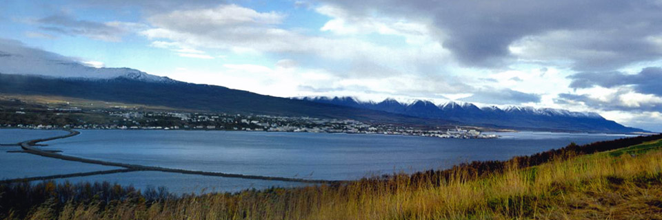 |
Akureyri, from across the fjord. It's a bigger town than it looks here.
 |
Goðafoss.
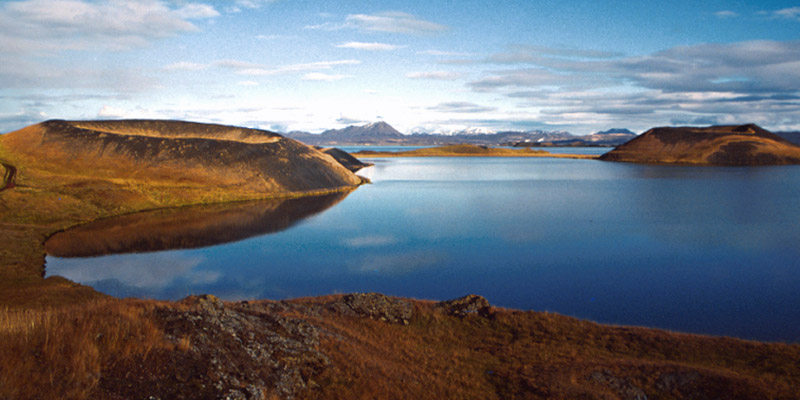 |
Pseudocraters on Lake Mývatn.
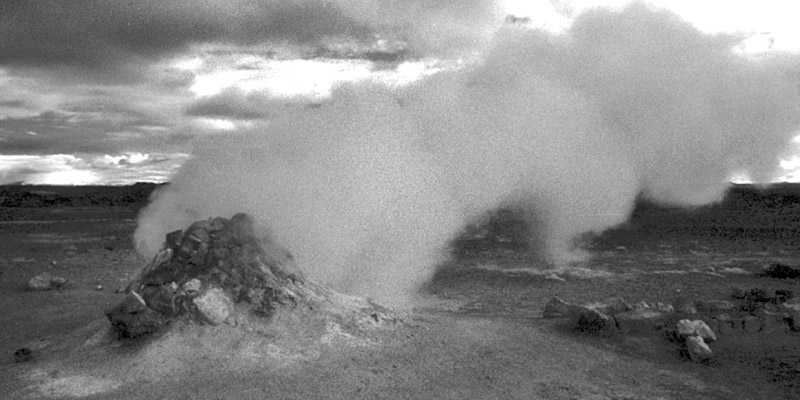 |
A steam vent in a geothermal field.
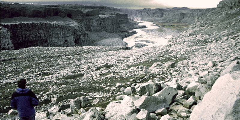 |
The gorge of Dettifoss.
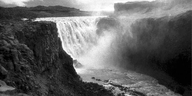 |
Dettifoss.
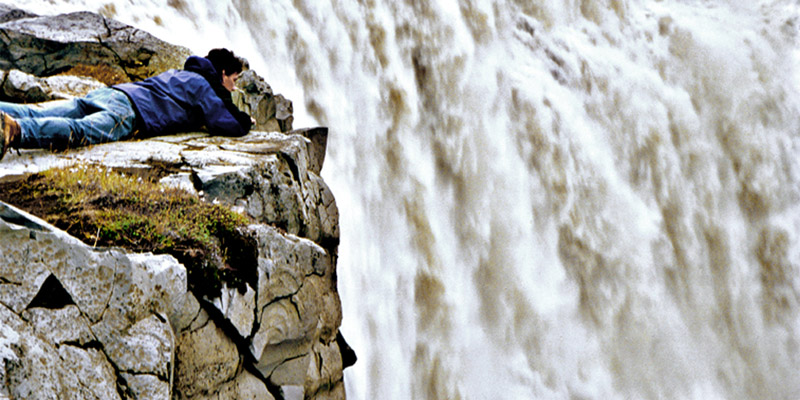 |
Win gets up close.
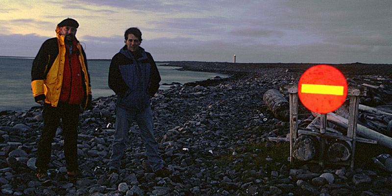 |
Farthest north, at Hraunhafnartangi--66° 31’35.6”N.
Next
The North Atlantic Arc Home
Mr Tattie Heid's Mileage
Results may vary