3
Thursday
We rise
early to catch our scheduled 6:45 ferry. This route was operated for years by
P&O, but the contract has just recently been awarded to a new company called
Northlink. I booked our passage online long before our trip. What no one has
bothered to tell us is that the brand-new Northlink ferry is much too large for
the pier at Scrabster, and the new government-built pier is months behind
schedule. A smaller ship has been leased from Caledonian MacBrayne (a partner in
Northlink), and the schedule has been adjusted. Our 6:45 crossing departed at
5:30. The next crossing is at 2:00pm, much too late for us to make our planned
connection to one of the outlying islands.
We are doubly fortunate.
There is another service departing from Gill’s Bay, 15 miles to the east, at
9:45. (I’d planned to use this ferry on our return trip.) And it’s October, and
we don’t have to worry about it being booked up. We sit in the parking lot at
Gill’s Bay; Win pops a DVD into his laptop. We plug the audio into the rental
car’s cassette player and pass an incongruous hour listening to Jethro Tull.
The crossing of the Pentland Firth is uneventful, if a bit rough; the
ferry has to make two attempts at docking. We disembark in St. Margaret’s Hope
on the southeastern island of South Ronaldsay. It’s the third largest town in
Orkney, tiny as it is, but we have no time to check it out, as we are well
behind schedule. We are booked on a ferry to the northern isle of Sanday in the
afternoon. South Ronaldsay is connected to the main island of Orkney, called
Mainland, by a series of causeways called the Churchill Barriers, built during
World War II to discourage the passage of German warships. Scapa Flow, the
rectangular body of water bounded by Mainland and the southern isles, is the
final resting place of a scuttled WWI German fleet, and is very popular with
divers.
We drive toward Kirkwall, the capital and largest town in
Orkney. To the west of town stands Wideford Hill, and a short hike up the side
of the hill brings us to Wideford Hill Chambered Cairn.
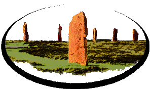
Orkney is
positively lousy with archeological sites. That’s why we’re here. A number of
factors make this a prehistorian’s paradise. One is that there are few trees
here, and ancient communities built everything with the flat slabs of stone that
are so readily available in Orkney. Another is that the climate changed at some
point several thousand years ago, turning fine agricultural land into peat bog,
and driving away rich schools of fish. Whole villages were abandoned and covered
by storm-driven sands, only to be uncovered again by storms many centuries
later. Such sites are still being discovered today. Most of Orkney’s ancient
sites are between 2,500 and 5,000 years old.
One of the hallmarks of the
early communities of the northern Scottish Highlands is the chambered tomb or
chambered cairn. Wideford Hill is a splendid example. No one knows exactly how
these tombs were used, but they are certainly burial sites of some kind.
Typically, they have a low, narrow passageway into a central chamber, which is
usually high enough to stand up in. There are several side chambers, in which
usually have been found human remains and a variety of artifacts. The whole is
built of stone, with a corbelled roof in the main chamber. At Wideford Hill,
access is through the roof, rather than the very tight passageway; the capstone
that normally tops the main chamber is missing, and has been replaced by a
sliding hatch and a ladder. If you don’t mind crawling in the dampness, you can
see the fine capstones atop the side chambers. Historic Scotland provides a
flashlight at many of these tombs, but it doesn’t hurt to bring your own.
We drive back into Kirkwall and board the afternoon ferry for Sanday
(pronounced “Sandy”—“ay” is the Orkney variant of the Old Norse word for island,
seen elsewhere as “ey” or “oy”). We land an hour and a half later and check in
at the Kettletoft Hotel. It’s late in the day, and we rush off to see the
spectacular Quoyness Chambered Tomb, much like Wideford Hill, but much larger,
and situated on flat ground near the beach. Nearby are the overgrown ruins of a
dozen other cairns. As darkness falls, we return to the Kettletoft. Our
accommodations are a bit spartan, but dinner in the pub is decent. There is a
cask ale at the bar, but it needs to settle another day. We make do
with one of the draught beers, which are not so bad. Behind the bar, sitting in
a small dish, is a potato, with facial features made from various vegetables,
and sprouts representing hair. “Who’s that?” I ask the lively barmaid. “Oh,
that's Mr Tattie Heid,” she bubbles (pronouncing the latter word “heed”). Win
will call me by that name ever after. I have called him “Blindhæd” since our
visit to Iceland a few years ago, after the road sign there denoting a blind
summit.
Next
|