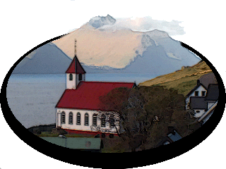
Return To Føroyar

5 October 2016
The North Atlantic Arc Home
| Octoberrrrrrrrrrrrrrrrrrrrrrr |
| S | M | T | W | T | F | S |
| 1 | ||||||
| 2 | 3 | 4 | 5 | 6 | 7 | 8 |
| 9 | 10 | 11 | 12 | 13 | 14 | 15 |
| 16 | 17 | 18 | 19 | 20 | 21 | 22 |
| 23 | 24 | 25 | 26 | 27 |
 |
|
Wednesday 5 October 2016--Despite being out a bit late last night, I wake
up much too early, and listen to rain tapping on the windows from 4:00 to 5:30 or
so. With another dreich day seemingly ahead, I sleep in until 10:30, when I look
out the window and see blue sky and sunshine. Crumbs. Get a quick coffee and
roll at Pubbin, make a short visit to the local tourist office, and head out on the
walk to Hvannhagi. I am unbelievably lucky to have such weather here. In fact, as
I walk up along the lane above town, through the gate and around the shoulder
of the hill, I find myself peeling off layers. The high today will be about 16°C
(60°F), warm enough when walking uphill in sunshine. I know from research that
the all-time record high in Tórshavn is 22°C (71.6°F). The all-time record high.
It never occurred to me that I might go hillwalking here in October in a t-shirt.
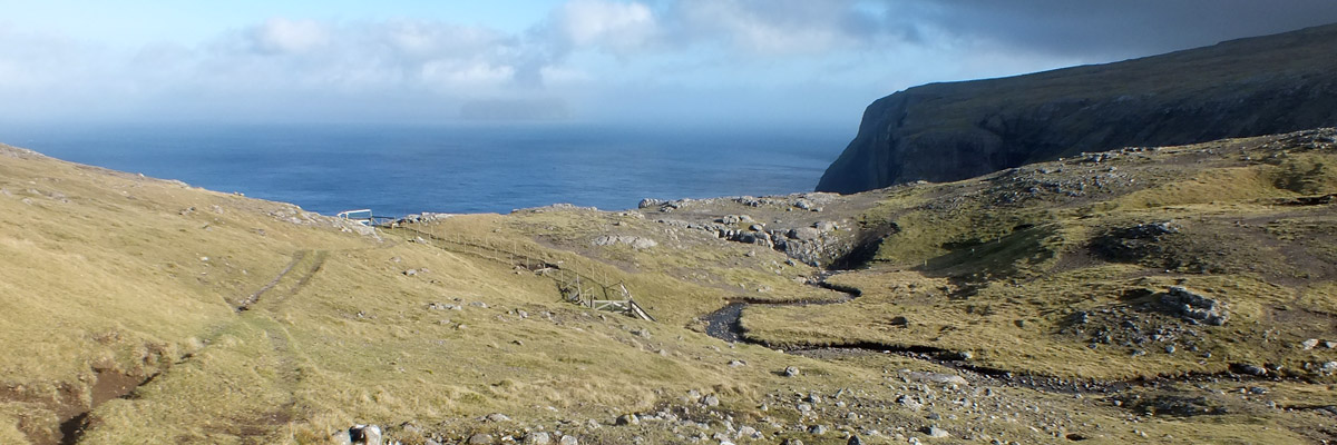
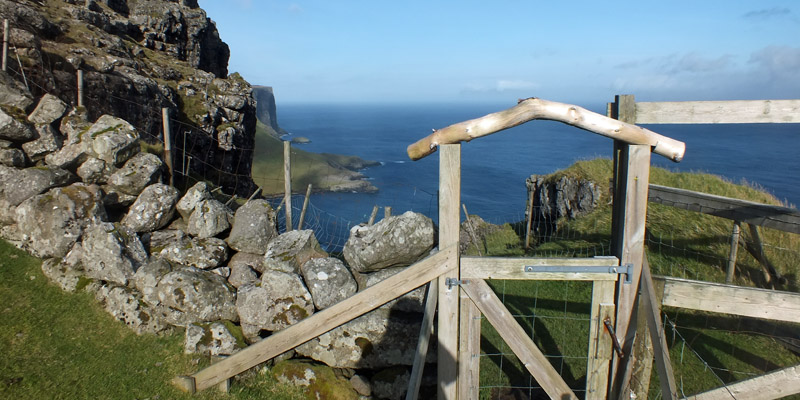
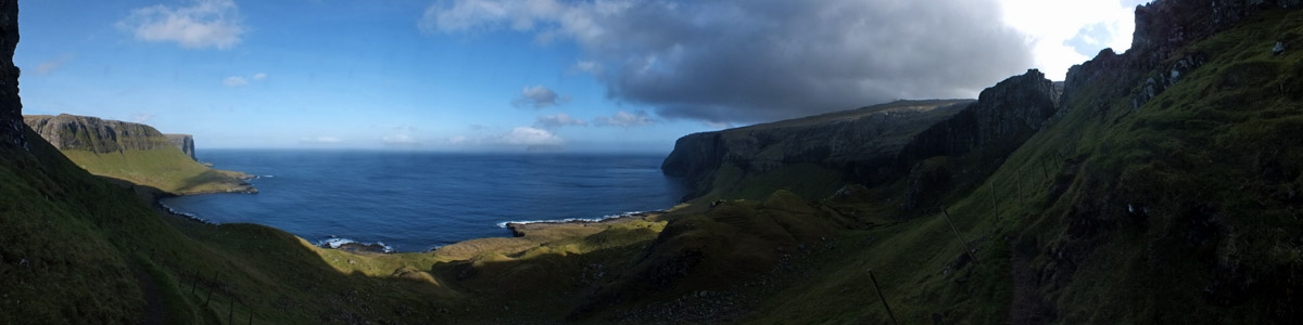
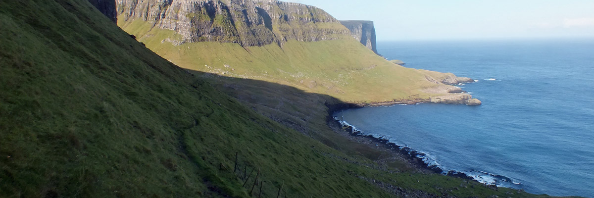
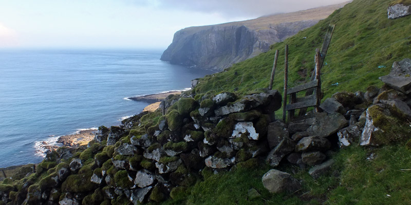
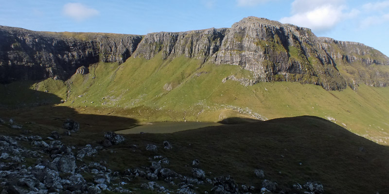
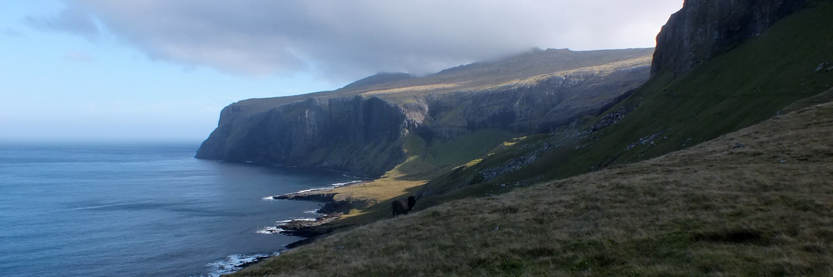
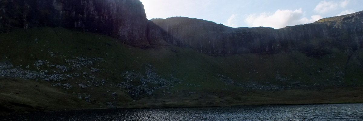
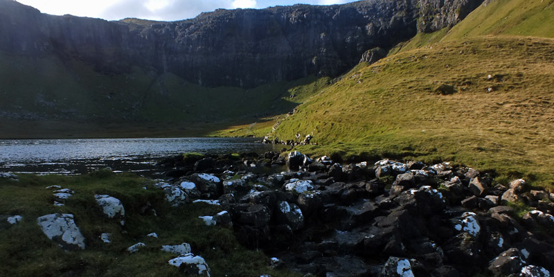
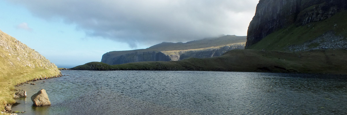
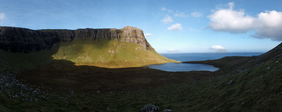
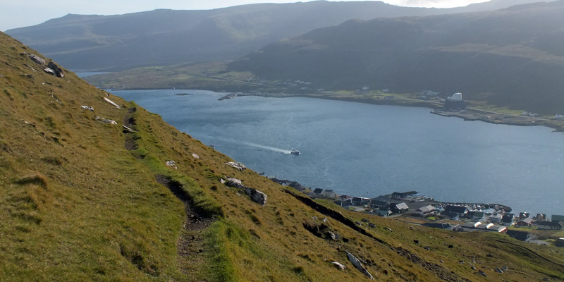
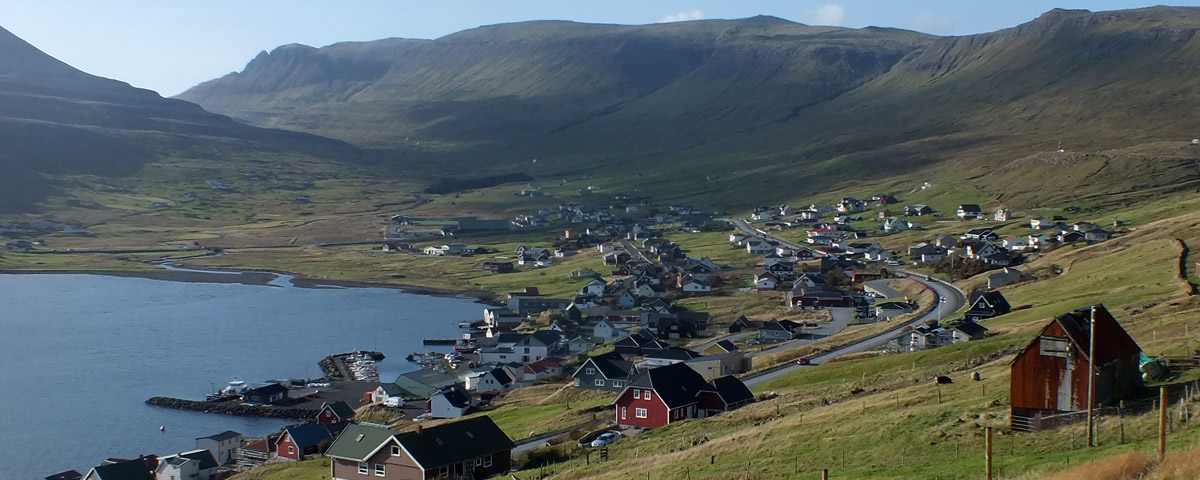
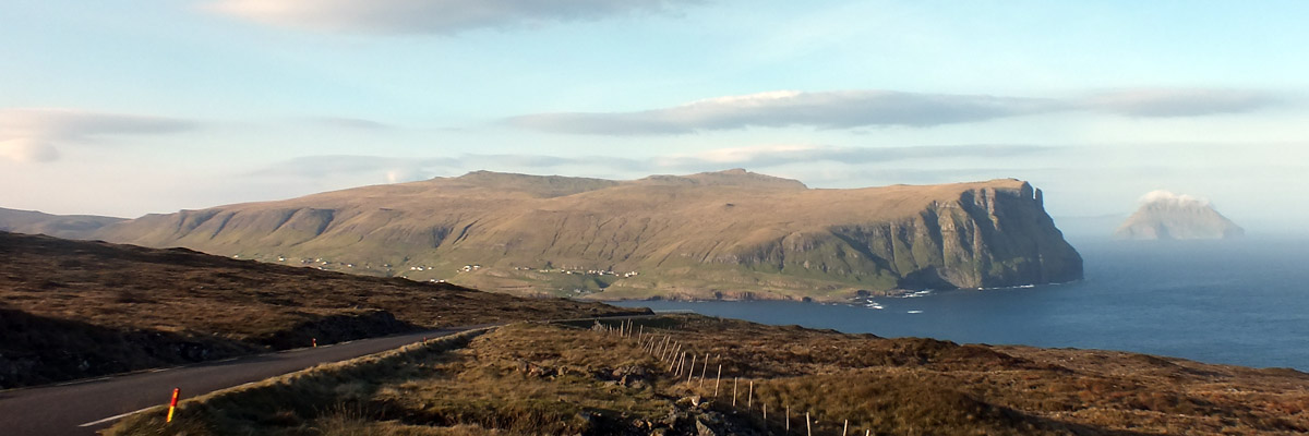
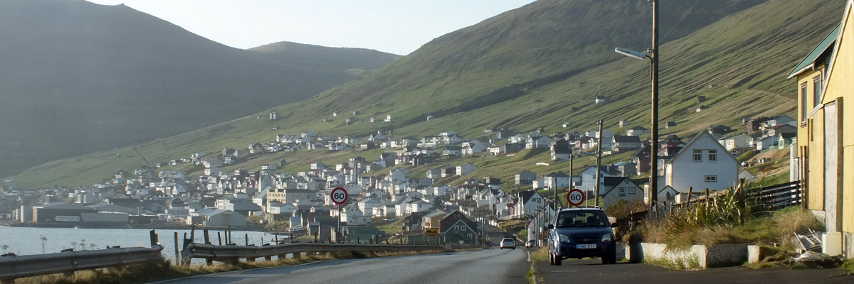
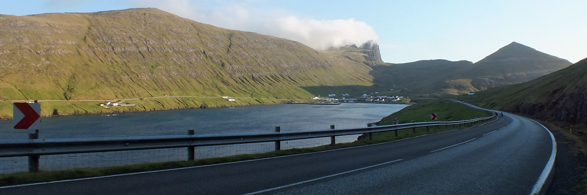
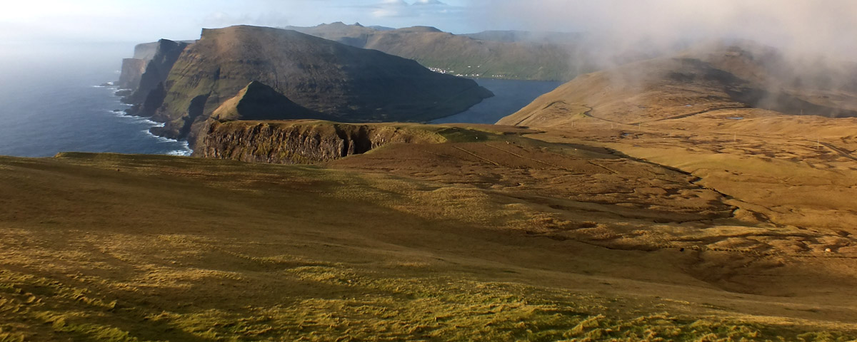
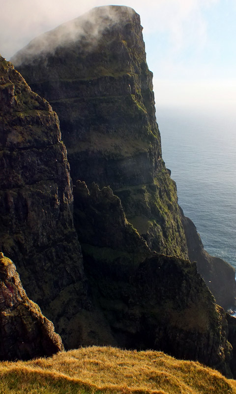
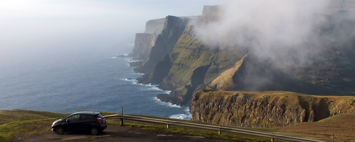
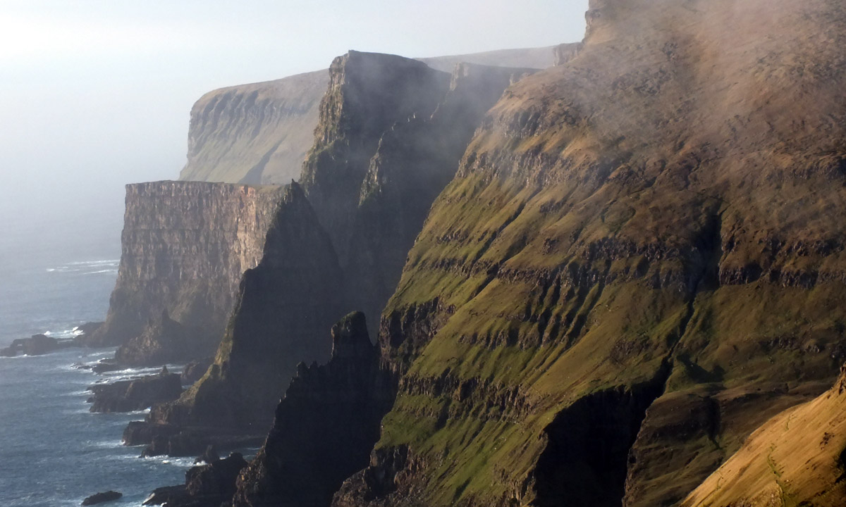
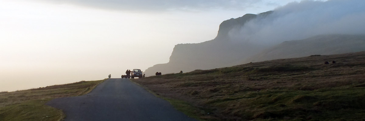
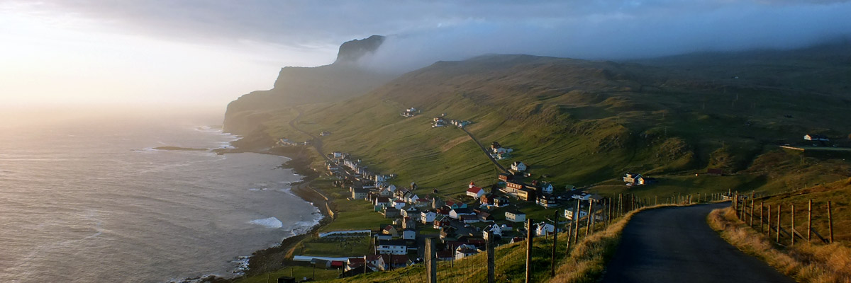
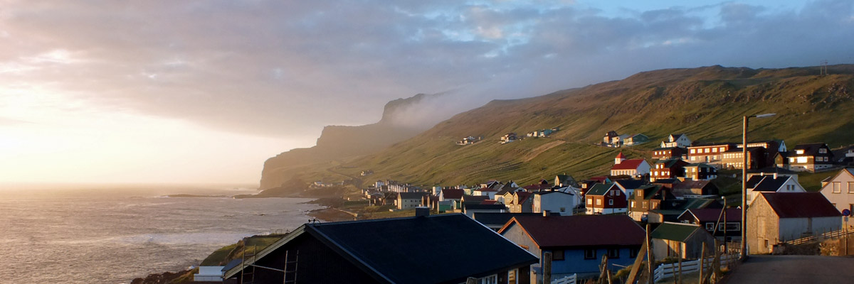
Hvannhagi is described in the tourist literature as a "natural beauty spot". I don't know that it's any more beautiful than any other spot around here, but it's a popular hike; sort of remote, but not too far, and definitely wild. The trail crosses a saddle between two craggy hills back of Tvøroyri, arriving at a gate above a north-facing cliff. From here, the islands of Lítla Dímun and Stóra Dímun are plainly visible, each with a fluffy cap of cloud. Lítla means "little" and stóra, "big"; no one is quite sure what dímun, believed to be pre-Norse Gaelic, means. Lítla Dímun strikes me as a perfect place for Irish monastic hermits, a Faroese Skellig Michael, if you will, although I know of no evidence that it was used that way. It's the smallest of Føroyar's eighteen islands, and the only one without human residents, not because it's small, but because it's very steep on all sides. Nonetheless, sheep are kept on it, which is a bit hard to understand. Rounding them up is difficult and hazardous. There is a monument in Hvalba that memorializes not only fishermen lost at sea and miners killed in the mines, but also shepherds who fell off Lítla Dímun. Stóra Dímun is occupied by a single family farm, which has a guesthouse, if you'd care to visit. Alas, there is no pub. Several other islands--Skúvoy, Sandoy, even Hestur and Koltur--are supposed to be visible from the clifftop on a clear day, but even with this lovely sunshine, there is a fairly heavy haze on the horizon. I pass through the gate and follow the narrow trail down the face of the escarpment, to the left. It's steep and rough, a bit precarious for me, but nothing small Faroese children can't handle, of course. Shortly, a small round lake appears, set in a grassy bowl, surrounded by a ring of cliffs. It is indeed a wild and pretty spot. I hang around for a while, taking photos, and then depart via a narrow cleft in the cliffs, an even steeper trail than the one coming down. I am overweight and out of shape, and it's slow going. At the top, I see a fellow tromping along ahead of me on the trail to town, the only human I've seen since departing. I don't know where he's coming from... maybe the trail to Hvalba. There are trails connecting villages all over the Faroes, the only overland routes back before roads were built, which is not as long ago as you might think. They are popular recreational paths now. It's not long before I'm back. The tourist literature says this is a two-and-a-half hour round trip; I've taken four. There's a few hours of daylight yet, enough time to see the rest of the island, or a good bit of it, anyway. I get in the car and drive to the far eastern end of the town, where I see the local fishermen's memorial. There is one in most every village, I think, testament to a hazardous way of life. Then I loop back around the head of Trongisvágsfjørður and head south. The main road to the southern end of Suðuroy passes through two tunnels, Hovstunnilin and Sumbiartunnilin. I've decided to take the older roads south, and use the tunnels on the return. Hovstunnilin, linking the villages of øravík and Hov, was built in 2007, and the road that it bypasses, looping around the headland, is still in good repair. I pass through Vágur and skirt Vágsfjørður to the village of Lopra. From there, the two-mile long Sumbiartunnilin (1997) leads to the southern end of Suðuroy. The old road passes over the mountain. It's the roughest road I've seen [and will see] in the Faroes, likely little-used except by tourists, probably impassable in winter conditions. But the views from the top are spectacular. Looking north, there is a panoramic sweep taking in Vágsfjørður on the east side of the island and utterly astonishing cliffs on the west. Turning south, I am faced with towering Beinisvørð, the highest sea cliff in Suðuroy at 470 meters. I do my best to photograph it, but I'm quite sure I haven't come close to capturing the dizzying verticality of it all. The road takes me up into the clouds, then out again and down past the village of Sumba toward the lighthouse at Akraberg. This is not quite the southernmost point of Suðuroy--Móanes, a half-mile west, extends a little farther--but it's as far south as the road goes. About three miles out, there is a little collection of skerries called Flesjarnar. One of these, Munkurin (the Monk), is the southernmost point of land in Føroyar. A late-day golden light bathes Sumba as I head back north, through the tunnels. As I pass through Vágur, I have an eye out for the pub, thinking I might stop for a pint and maybe dinner. I spent some time while planning trying to decide whether to stay here or Tvøroyri--in truth, trying to decide which pub looked better. I'm happy with my choice, but would still like to see the one here. I don't spot it, though, and continue on my way. Just as well--I really shouldn't be driving the rental car with even one beer in me. Besides, there is just enough day left to drive over the winding road to Fámjin, a village of about a hundred. I'm too late to visit the church, which houses an unusually late (16th-century) runestone and the prototype of the Faroese flag. The flag was first flown at a wedding in Fámjin on June 22, 1919, but the Danish authorities, perhaps disinclined to encourage Faroese nationalism, suppressed its use. During World War II, however, Føroyar was occupied by the British, who sanctioned the Faroese flag rather than fly the flag of Nazi-occupied Denmark. Even after the war, the Danes didn't really accept it until Føroyar won home rule in 1948. I watch the sun set, then drive the ten miles back to Tvøroyri. In Pubbin, I reflect on a marvelous day exploring Suðuroy. I'm really glad I came here, and am already thinking about coming back. There are some villages and road-ends I didn't get to, and I'm sure some trails to walk and hills to climb. There is the church at Fámjin, a couple of small museums, and of course, the pub at Vágur. Honestly, I would love simply to spend more time taking in the ambience of the one significant part of Føroyar that is not within an easy drive of Tórshavn. It's probably not accurate or fair to say that Suðuroy is the most quintessentially Faroese experience, but it is certainly a very distinctive one. Next |
 |
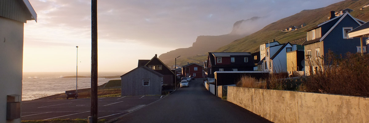
Guesthouse And Rental Car, Tvøroyri
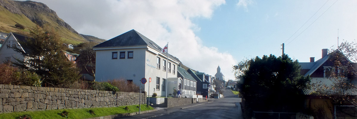 |
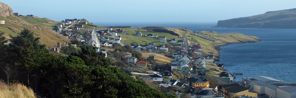
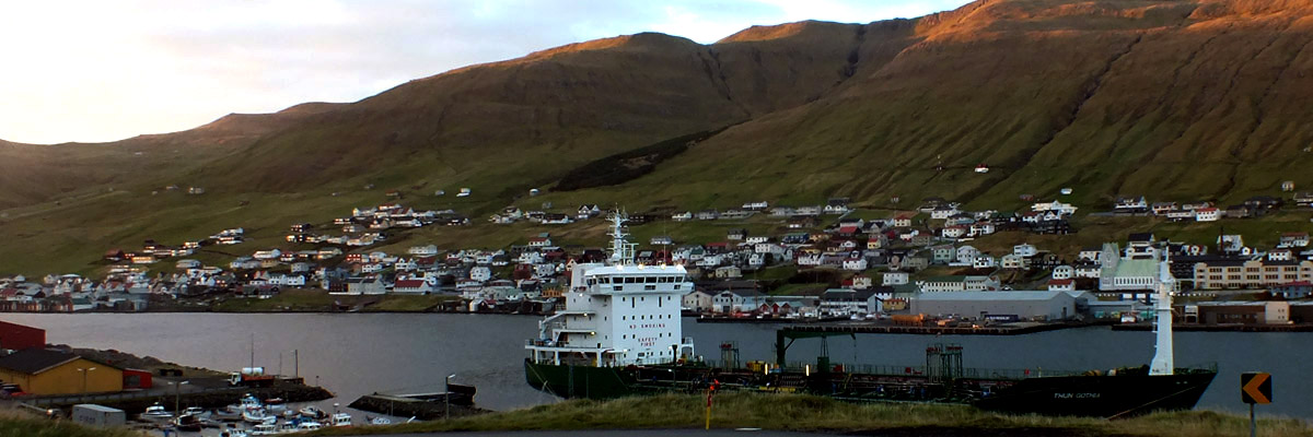
Tvøroyri
 |
Back Lane
 |
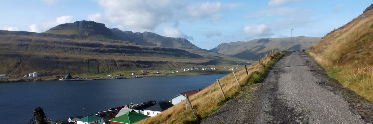
Trongisvágsfjørður
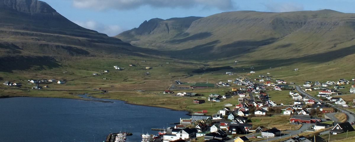 |
Trongisvágur
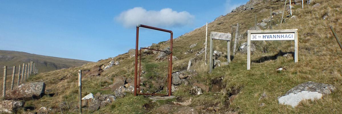 |
This Way To Hvannhagi
 |
Trail
 |
The Other Side
 |
Gate
 |
Beyond The Gate
 |
Trail
 |
Stilin'
 |
Hvannhagi
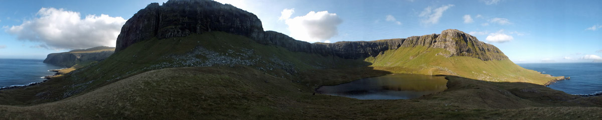 |
360 Of Hvannhagi
 |
Lítla Dímun
 |
View East
 |
Hvannhagi
Exit route marked by sunbeam
 |
Hvannhagi
 |
Hvannhagi
 |
Hvannhagi
 |
Hvannhagi
 |
Way Out
 |
Last Look
 |
Hillwalking
 |
Trongisvágsfjørður
 |
Trongisvágur
 |
Tvøroyri
 |
Through The Woods
 |
And Out
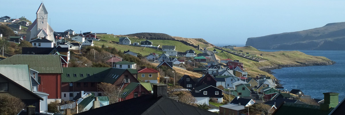 |
Tvøroyri
 |
Lost At Sea
 |
Trongisvágsfjørður
 |
Tvøroyri
 |
Looking Back
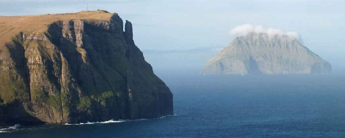 |
Lítla Dímun
 |
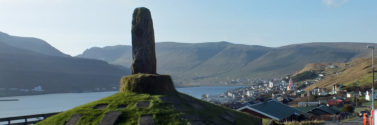
Vágur
 |
Vágur
 |
Vágsfjørður
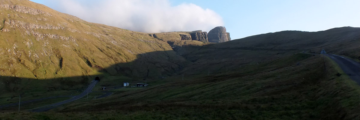 |
Tunnel And Mountain Road
 |
I Am Speechless
 |
Beinisvørð
 |
Cliffs Of Suðuroy
 |
Close-Up
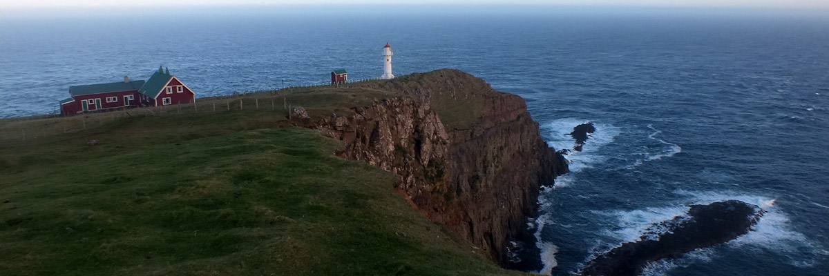 |
Akraberg, My Friend
 |
Chinwag At Akraberg
 |
Sumba
 |
Sumba
 |
Sumba
 |
Vágur
 |
Fámjin
 |
Sunset At Fámjin
 |
Fámjin
 |
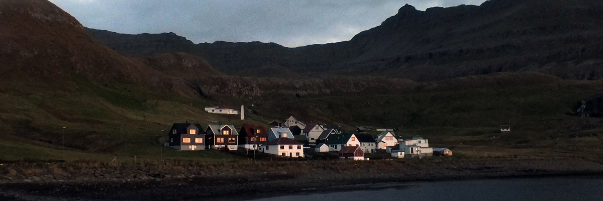
Tvøroyri
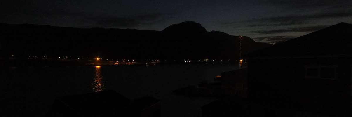 |
Night Falls On Trongisvágsfjørður
Next
| Octoberrrrrrrrrrrrrrrrrrrrrrr |
| S | M | T | W | T | F | S |
| 1 | ||||||
| 2 | 3 | 4 | 5 | 6 | 7 | 8 |
| 9 | 10 | 11 | 12 | 13 | 14 | 15 |
| 16 | 17 | 18 | 19 | 20 | 21 | 22 |
| 23 | 24 | 25 | 26 | 27 |
The North Atlantic Arc Home
Mr Tattie Heid's Mileage
Results may vary