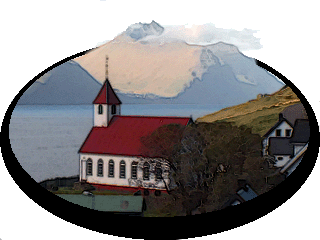
Return To Føroyar
8 October 2016
The North Atlantic Arc Home
| Octoberrrrrrrrrrrrrrrrrrrrrrr |
| S | M | T | W | T | F | S |
| 1 | ||||||
| 2 | 3 | 4 | 5 | 6 | 7 | 8 |
| 9 | 10 | 11 | 12 | 13 | 14 | 15 |
| 16 | 17 | 18 | 19 | 20 | 21 | 22 |
| 23 | 24 | 25 | 26 | 27 |
 |
|
Saturday 8 October 2016--I'm headed up to the northern isles today. My
original plan was to spend two nights in Klaksvík, but I've decided to stay in
Tórshavn, and just make a daytrip north. My rationale is that I'm comfortable in
Hotel Streym, Tórshavn has the best dining and drinking options, and you can
drive almost anywhere in Føroyar (outside of Suðuroy and a few other small
islands) in an hour or so. In all honesty, I'm just too lazy to search for a room in
Klaksvík, and move. As the friendly gent at the front desk is putting me in the
book, I tell him that my room was rocking the other night after the crossing from
Suðuroy, but was much steadier last night. "Yes, I fixed that," he deadpans.
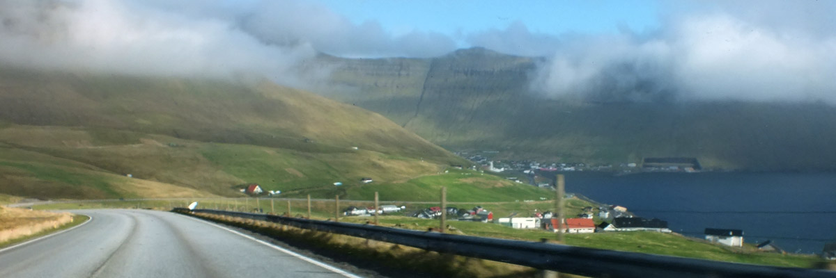
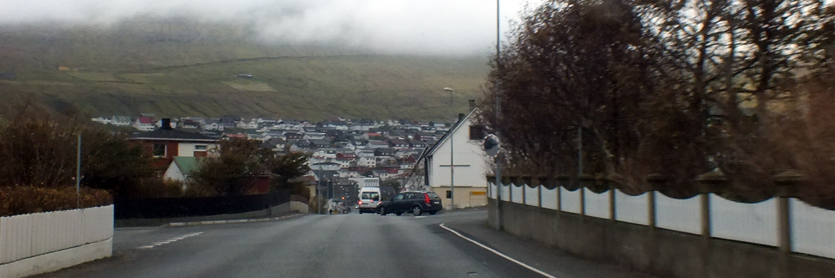
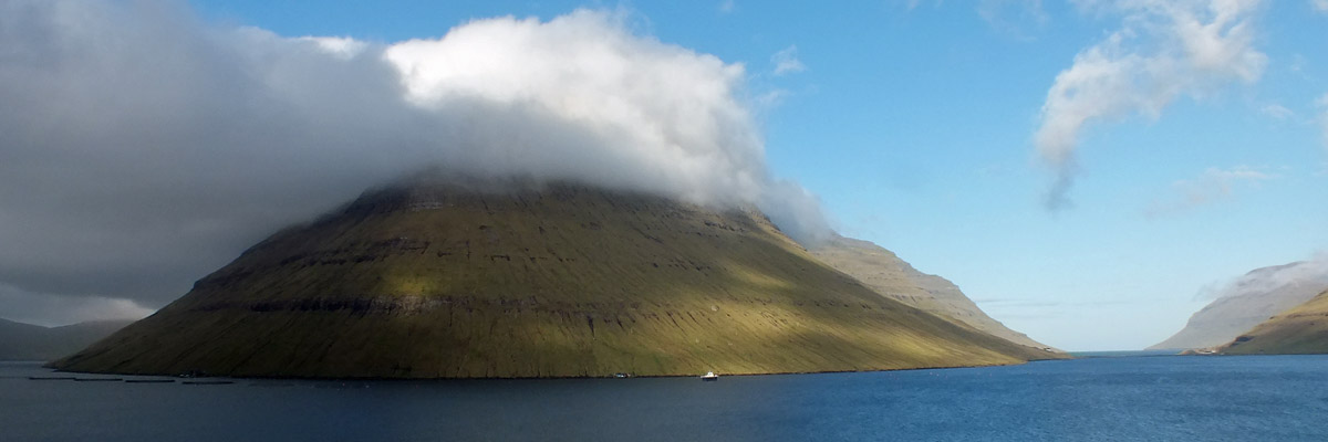
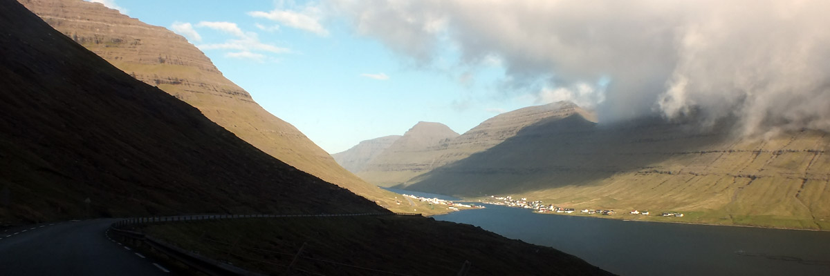
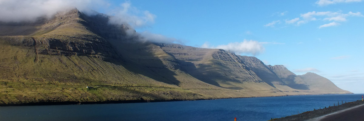
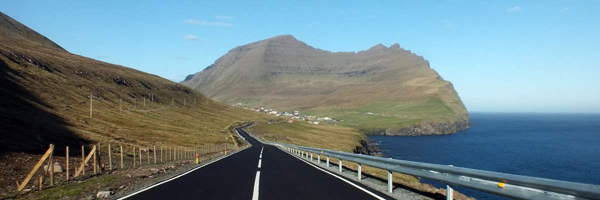
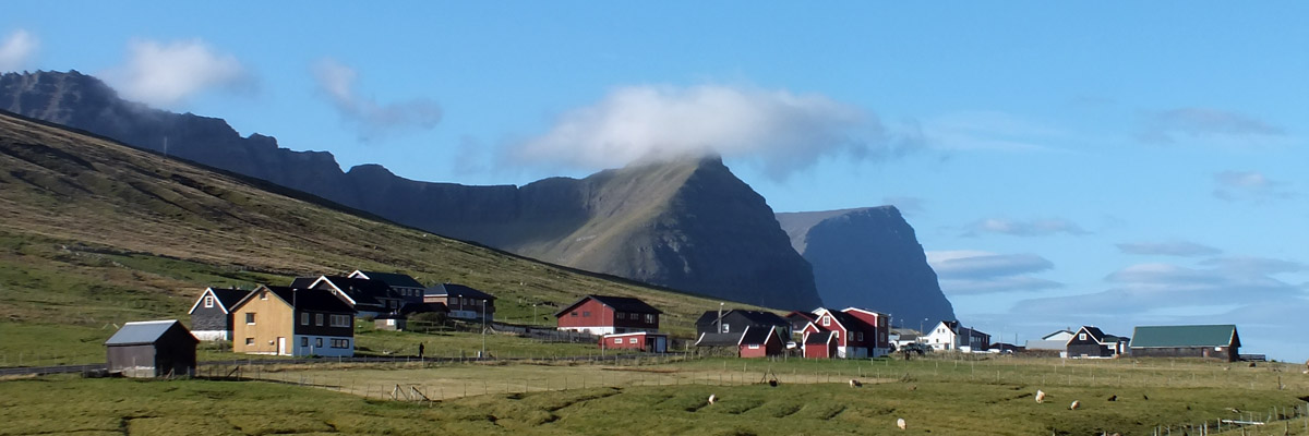
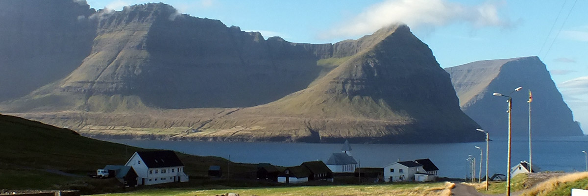
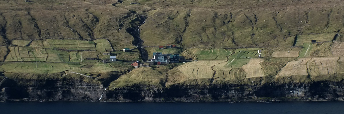
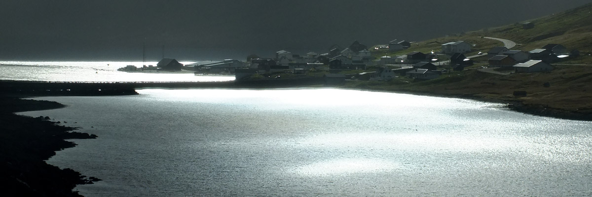
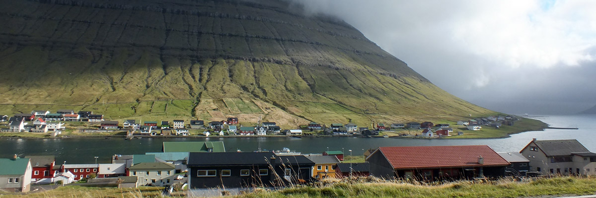
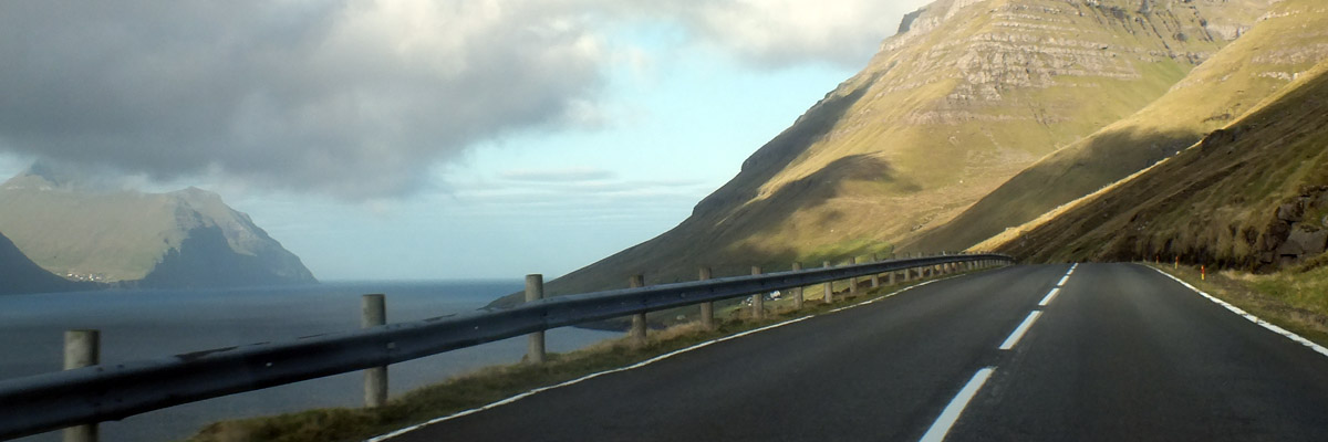
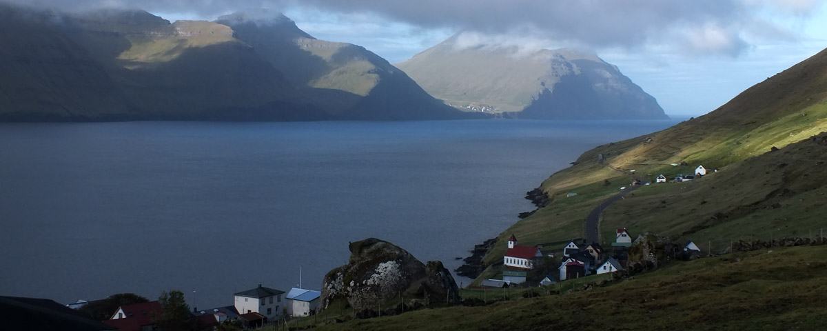
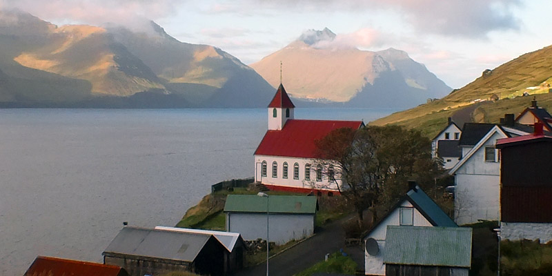
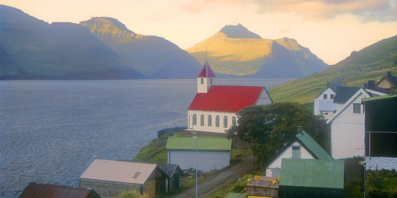
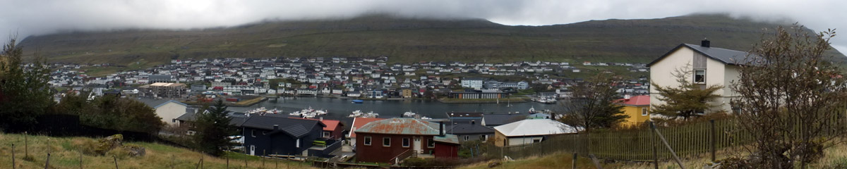
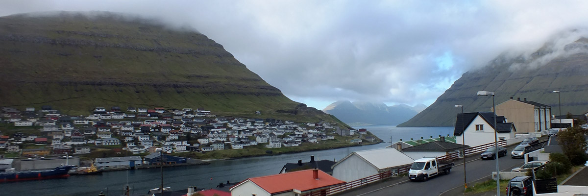
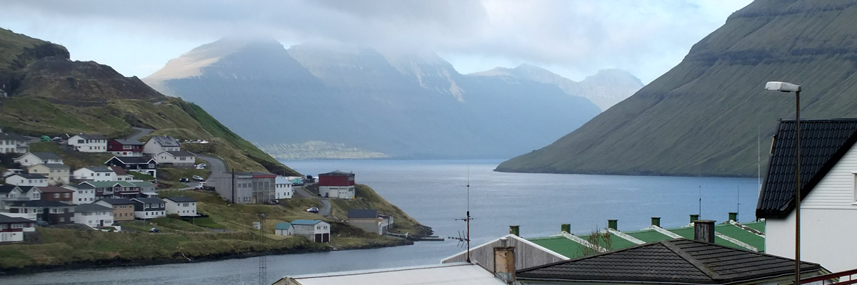
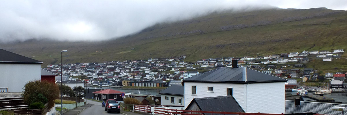
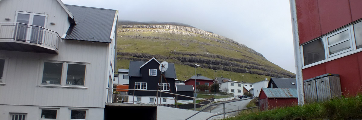
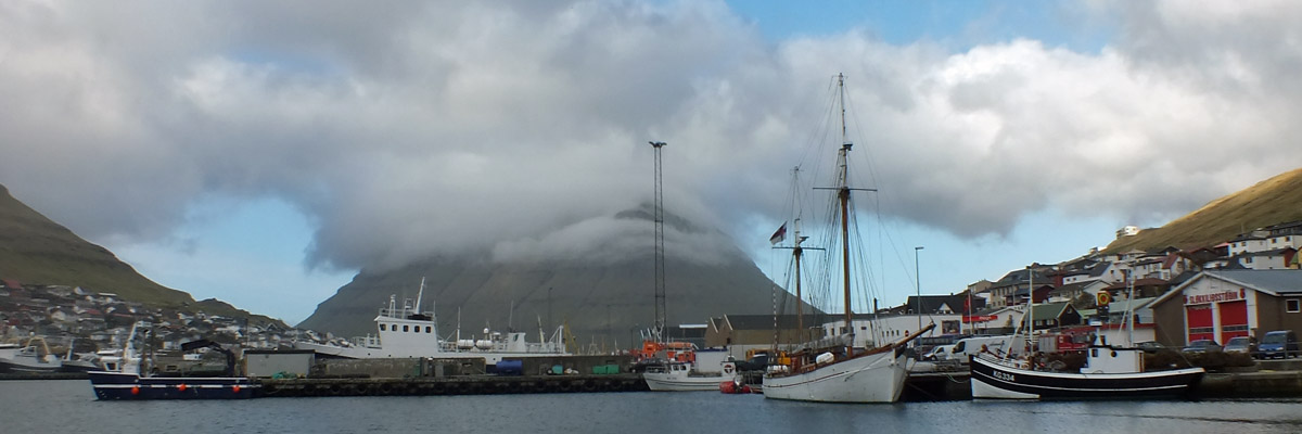
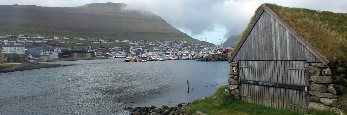
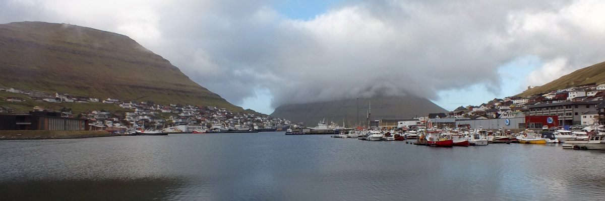
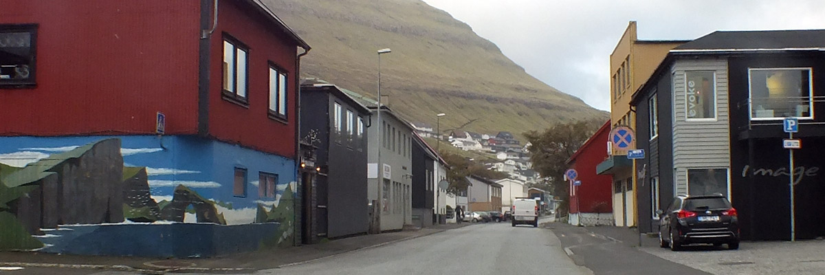
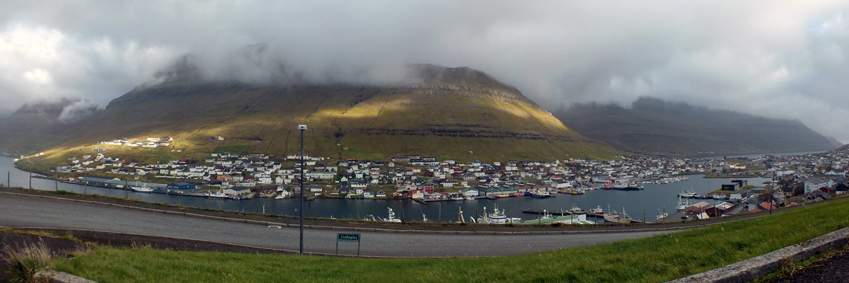
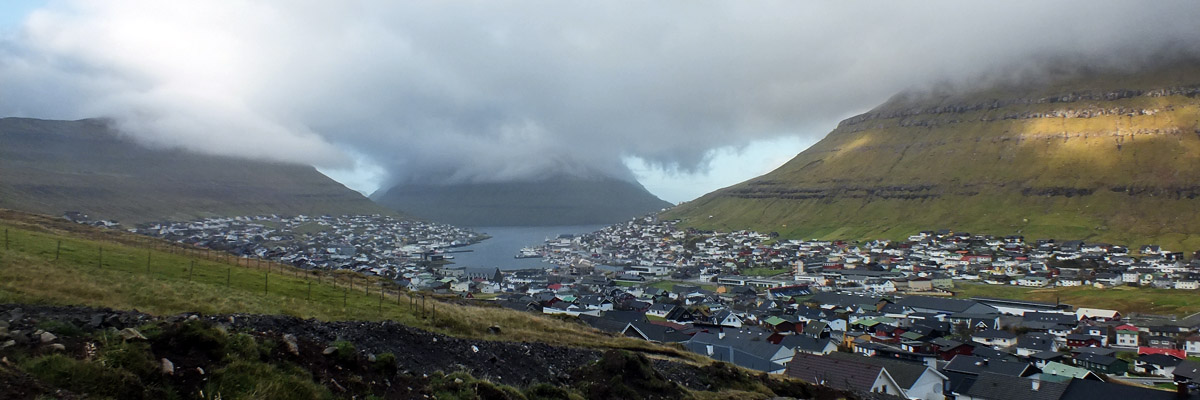
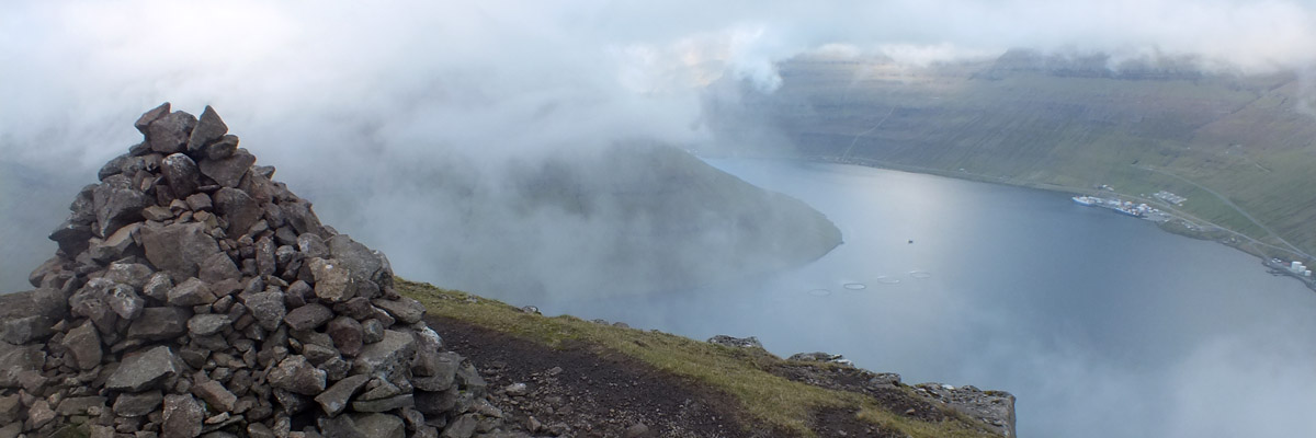
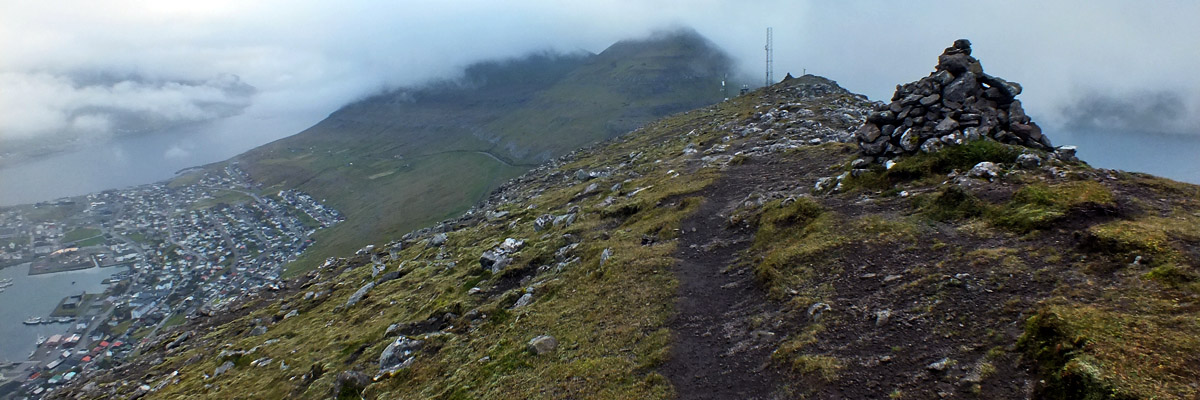
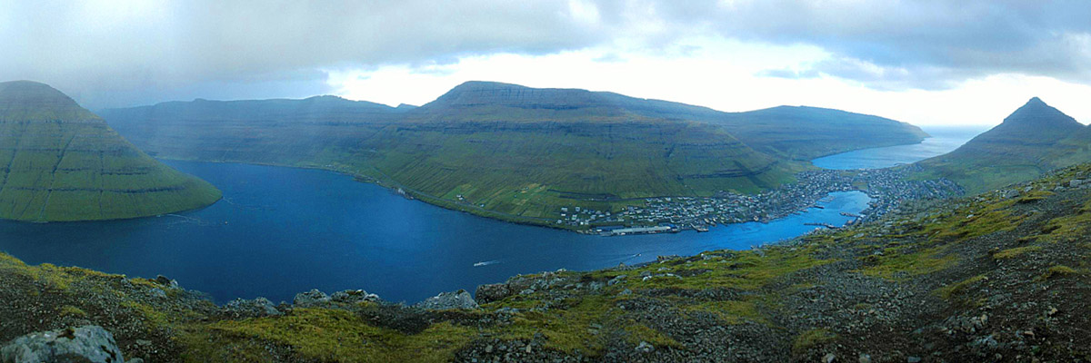
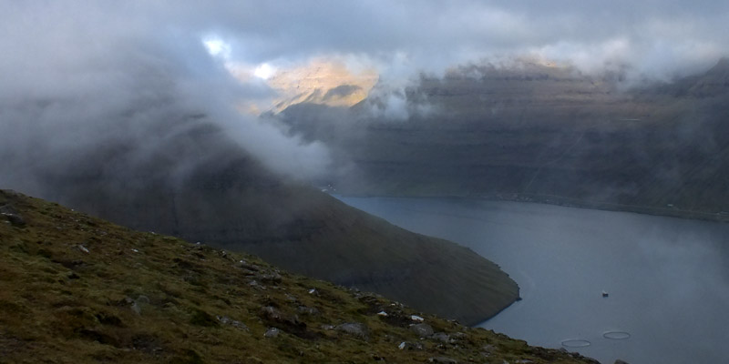
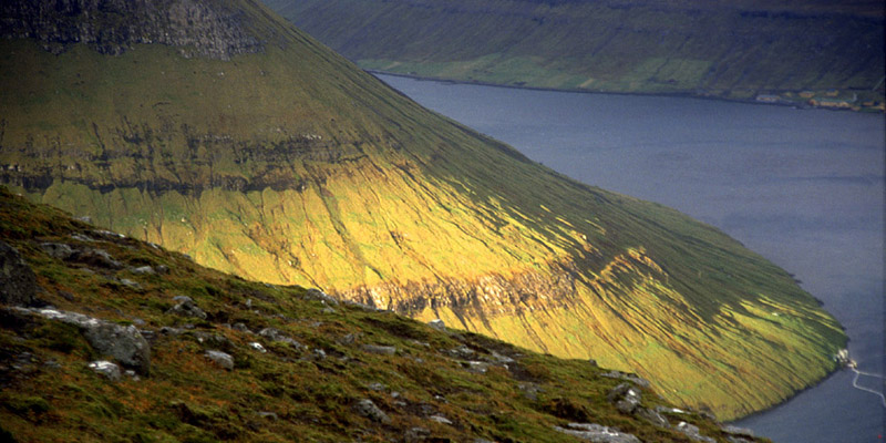
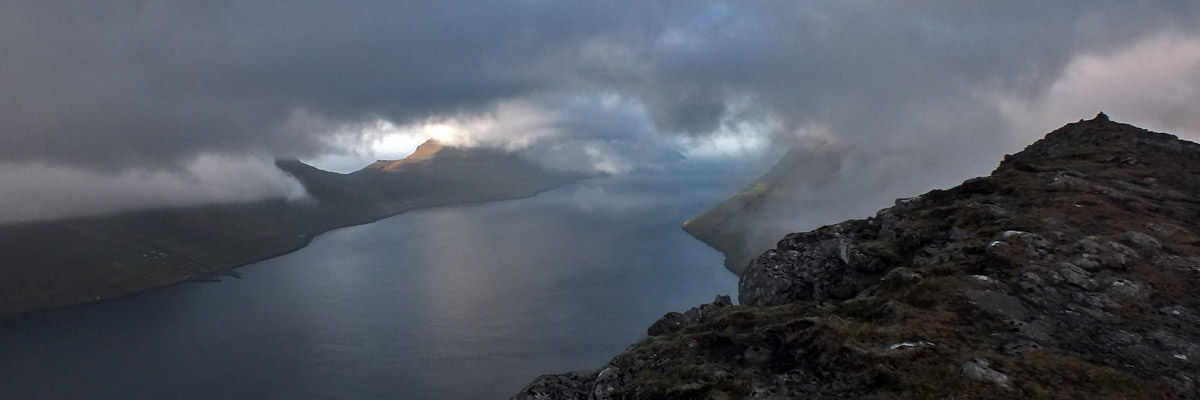
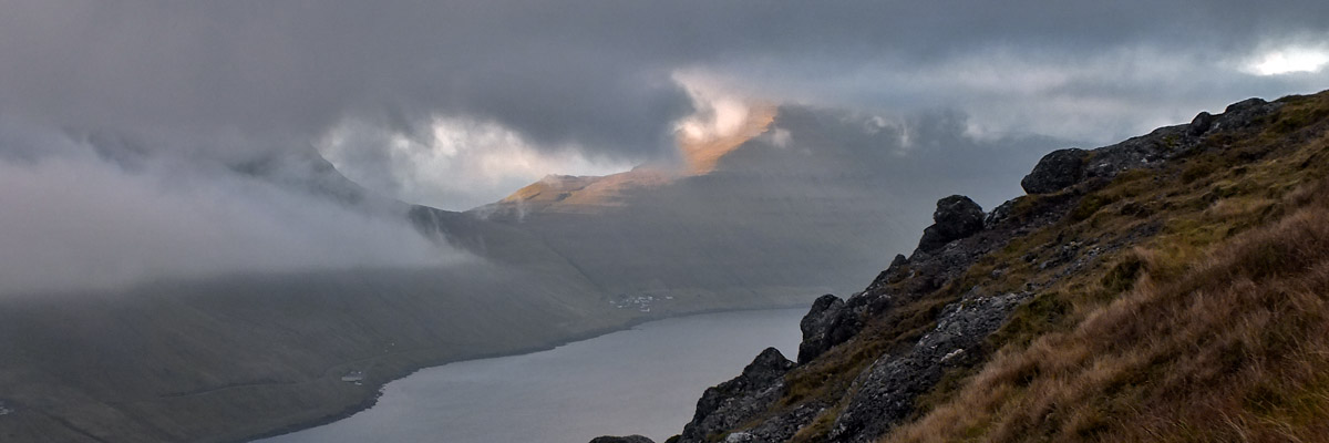
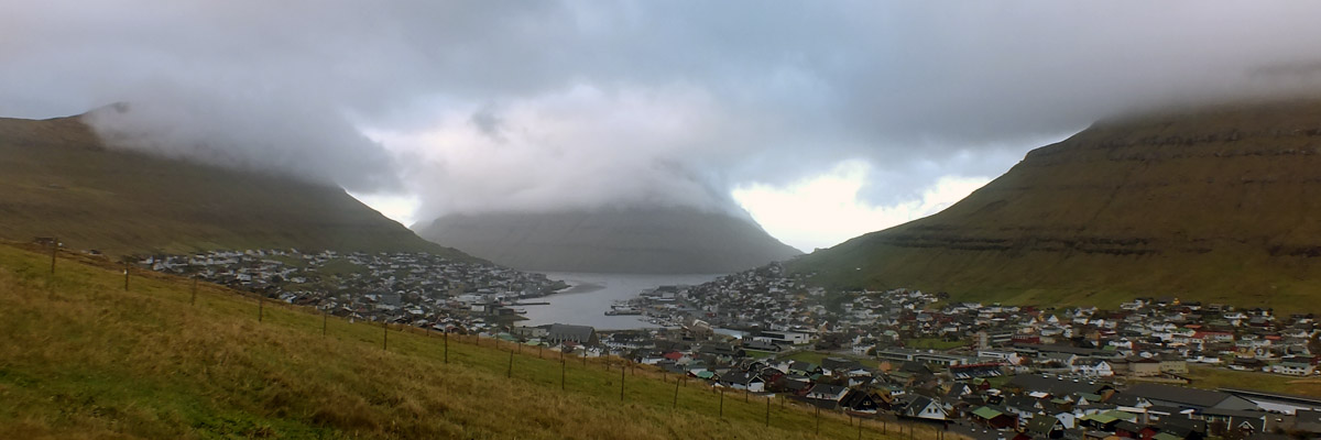
On my way out of town, I stop at Rúsdrekkasøla Landsins, the state liquor store. There are exactly six outlets in all of Føroyar, and this one in a commercial area on the edge of town is the flagship store. Surprisingly, there is none downtown--if you want to be a drunk here, you have to have a car, I guess. I'm looking for a bottle of whisky to replace the half-liter of Nikka I bought at Keflavík. I'm pleasantly surprised by the selection, which is not enormous, but a lot better than expected. I'm not surprised by the prices, which are typically Scandinavian. A bottle of Aberfeldy, at around $75, is the most reasonable thing I see, although that's about twice what I'd pay for it at home. North through the tunnel I go, then over the bridge that crosses the narrowest point of Sundini. The road winds across Eysturoy, Føroyar's second-largest island, passing through Norðskálatunnilin (1976) and Leirvíkartunnilin (1985) on the way to Leirvík. This is where, in 2001, I boarded the ferry for Klaksvík. It was a magical half-hour trip, crossing a patch of water nestled in among the headlands of Kalsoy, Kunoy, and Borðoy, with no sign of civilization save the vessel itself. I knew then that I'd never do it again, because Norðoyatunnilin, the Northern Isles Tunnel, was already under construction. And through that tunnel I breeze today, arriving in Klaksvík in a few minutes. Klaksvík forms a narrow U around its fjord, with the southern tip of Kunoy guarding its harbor like a cork in a test tube. It's the second-largest town in Føroyar--the overwhelming majority of Borðoy's 5,000 residents live here. I have something of a soft spot for these second-fiddle towns, like Akureyri in Iceland, and as I pass through, I feel a pang of regret about not staying here. The road north passes up along the east side of the fjord. Just outside town, there is a fork, with one branch continuing along the shore toward the causeway to Kunoy. I'll come back to this; right now, I make the sharp turn into árnafjarðartunnilin. This mile-long tunnel is the second-oldest in Føroyar, completed in 1965. At the end, there is a short elbow of road leading to Hvannasundstunnilin, the third oldest tunnel (1967). Consistent with their age, these two tunnels are very narrow and unlit, and seem to me to be good candidates for replacement. There is a road junction at the exposed elbow, leading down to the village of árnafjørður (pop ~50). I'm fairly sure I went down there in 2001, but today I continue on through the second tunnel, emerging on the east coast of Borðoy. It's another mile and a half down to the short causeway between the villages of Norðdepil and Hvannasund, on the islands of Borðoy and Viðoy, respectively. A traffic light at one end appears to be utterly pointless. I imagine it was installed during construction on the causeway. Across the causeway, the old road north to Viðareiði is cut into the steep western slope of the island. This road is subject to frequent landslips and can sometimes be closed for days, so a new tunnel, Viðareiðistunnilin, was opened this year. The tunnel and road are a virtual highway, seeming overkill to service a village of about 350. Viðareiði is said to be the northernmost settlement in Føroyar--as near I can figure, it extends just a few yards farther north than the hamlet of Trøllanes (pop 27) on Kalsoy. The sun is shining here, the northern tips of Viðoy, Borðoy, Kunoy, and Kalsoy like four fingers reaching out from under the blanket of cloud that covers most of Føroyar. Viðareiði is backed by a high, steep mountain, and I know from looking at maps that there is much more to the headland beyond than it appears from the village. The jagged promontory culminates in Enniberg, the northernmost point of the archipelago, at 754 meters (2,474 ft) reputedly the highest sea cliff in Europe. I take such claims with a grain of salt--one source claims Enniberg is "the highest vertical cliff in the world," which is nonsense. The Troll Wall in Norway, for example, is 1,100 meters (3,600 ft), and Hornelen in the same country also claims to be the highest sea cliff in Europe at 860 meters (2,820 ft), although it is not so straight a drop as Enniberg. Such claims depend, I suppose, on how you define things. I return to the causeway via the old road on the west side. Signs say it is closed, but apparently they haven't quite gotten around to it yet. Guess that's the last time I'll do that. Along the way, there is a view to the tiny settlement of Múli, at the end of a rough road at the northern end of Borðoy. I've seen it listed as abandoned, but Wikipedia credits it with a population of four. [My journals confirm that I drove out there in 2001, and walked a little way farther north, although I don't really remember. In his second Faroes novel, The Killing Bay, Chris Ould makes it the site of a fictional 1970s hippie commune.] Over the causeway and through the two tunnels crossing Borðoy I go, then across the causeway to the island of Kunoy. Kunoyartunnilin (1988) leads nearly two miles to the west side, and the road turns north to the village of Kunoy. There are lovely views across to Kalsoy, a long slender island with a single road running its length, through five tunnels built between 1979 and 1985. The island is known colloquially as The Flute. (Actually, the literal translation is The Recorder, but that's confusing in English). It occurs to me that these five tunnels (along with the one to Gásadalur, which I'll visit in a couple of days) are now the only completed ones in Føroyar that I haven't traversed. I'd hoped to do so, when I was planning to spend two nights in Klaksvík...it'll have to wait for another time. Just now, I'm hoping to find the vantage point from which I took one of my favorite photos in 2001, looking over Kunoy toward the village of Mikladalur, metropolis of Kalsoy (pop ~40). I'm not sure that I will recognize the exact spot, but I know it immediately when I'm on it. It's almost spooky looking at that familiar scene on the camera's screen. I backtrack to Klaksvík, park the car, and go for a walk around, stopping in at a café for a cup of coffee and cake. A bookstore across the street has a sign advertising Postkort (postcards), but when I investigate, I find the opening hours on Saturday are 12:00-2:00. Shopping is perhaps not a big activity in a town like this. Decide to ascend Klakkur, the easily accessible peak at the northern end of the ridge west of town. I did this in 2001, too, in much sunnier weather. Just now, the clouds are swirling around the peaks of the isles, but I manage to get a few decent views, making the hike up worthwhile. Bomb back to Tórshavn, arriving at sunset, and rest a bit in my room, before going out in search of dinner. After some fruitless dithering, I end up in Hvonn again. My steak is not very good, small in size and large in price. I probably should have stayed in Klaksvík after all...the few restaurants there are likely just as lousy as the ones here, but at least they're different lousy restaurants. [I should note that Tórshavn features a number of highly-regarded top-end restaurants, which are beyond my budget and resolutely middlebrow tastes.] Next |
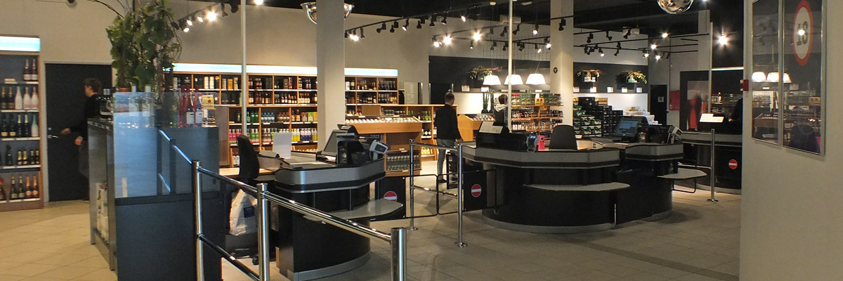 |
Rúsdrekkasøla Landsins
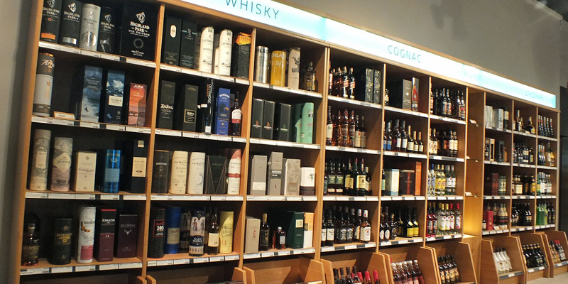 |
Whisky
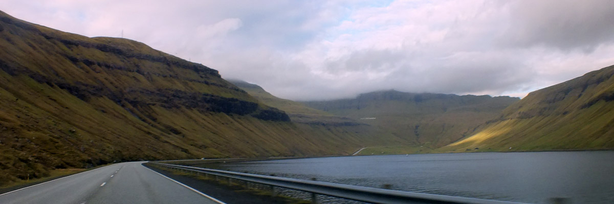 |
Northbound Again
 |
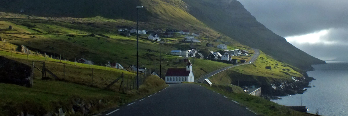
Syðrugøta, Toward Norðragøta
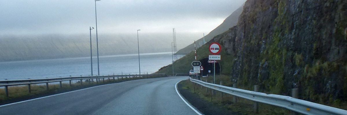 |
Norðoyatunnilin
 |
Klaksvík
 |
Kunoy
 |
Causeway To Viðoy
 |
Borðoy From Viðoy
 |
Approaching Viðareiði
 |
Viðareiði
 |
Borðoy And Kunoy From Viðareiði
 |
Múli
 |
Norðdepil From Hvannasund
 |
Hvannasund From Norðdepil
 |
Road To Kunoy
 |
Kalsoy From Kunoy
 |
Kunoy
 |
Kunoy, 2016
 |
Kunoy, 2001
 |
Klaksvík
 |
Klaksvík
 |
Kalsoy And Kunoy From Klaksvík
 |
Klaksvík
 |
Klaksvík
 |
Klaksvík
 |
Klaksvík
 |
Klaksvík
 |
Klaksvík
 |
Klaksvík
 |
Klaksvík
 |
Klaksvík
 |
Klaksvík From Klakkur
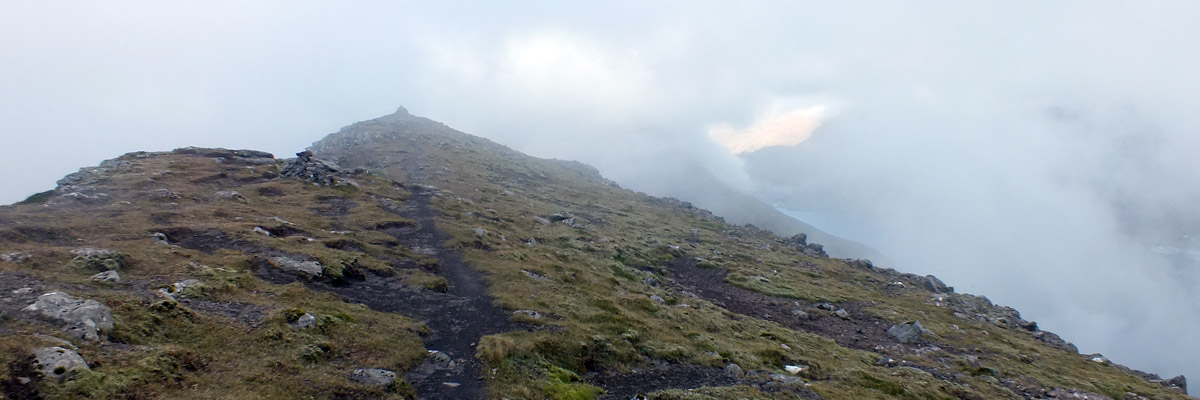 |
Klakkur
 |
On Klakkur
 |
On Klakkur
 |
View From Klakkur, 2001
 |
On Klakkur
 |
On Klakkur, 2001
 |
On Klakkur
 |
On Klakkur
 |
Klaksvík
Next
| Octoberrrrrrrrrrrrrrrrrrrrrrr |
| S | M | T | W | T | F | S |
| 1 | ||||||
| 2 | 3 | 4 | 5 | 6 | 7 | 8 |
| 9 | 10 | 11 | 12 | 13 | 14 | 15 |
| 16 | 17 | 18 | 19 | 20 | 21 | 22 |
| 23 | 24 | 25 | 26 | 27 |
The North Atlantic Arc Home
Mr Tattie Heid's Mileage
Results may vary