
Friends In Three Countries

3 October 2017
The North Atlantic Arc Home
| September | /October/ | November |
| S | M | T | W | T | F | S |
| 24 | 25 | 26 | 27 | 28 | 29 | 30 |
| 1 | 2 | 3 | 4 | 5 | 6 | 7 |
| 8 | 9 | 10 | 11 | 12 | 13 | 14 |
| 15 | 16 | 17 | 18 | 19 | 20 | 21 |
| 22 | 23 | 24 | 25 | 26 | 27 | 28 |
| 29 | 30 | 31 | 1 |
 |
|
Tuesday 3 October 2017--We cancel our lodgings in Egilsstaðir and Höfn
this morning, the washed-out road in the southeast still reportedly closed. We
waited as long as we could. As disappointed as we are that we will not complete
our trip around the Ring Road, we are both looking forward to another couple
of nights in Reykjavík. I'm thinking that I've lost my one chance to see the
Eastfjords and the whole eastern part of Iceland, but oddly enough, I feel at
peace with it. I have in recent years felt some urgency in ticking off boxes on my
travel bucket list, and I still do. At the same time, there has come a slowly growing
acceptance of the fact that I won't get to all of it. There's nothing to do about it
but keep on doing what you can, while you can.
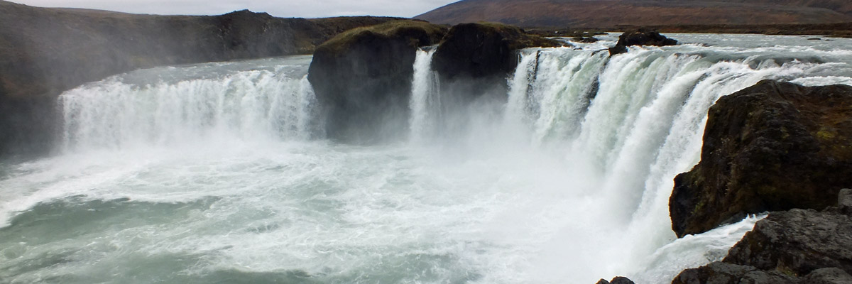
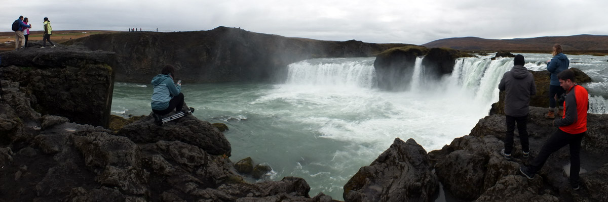
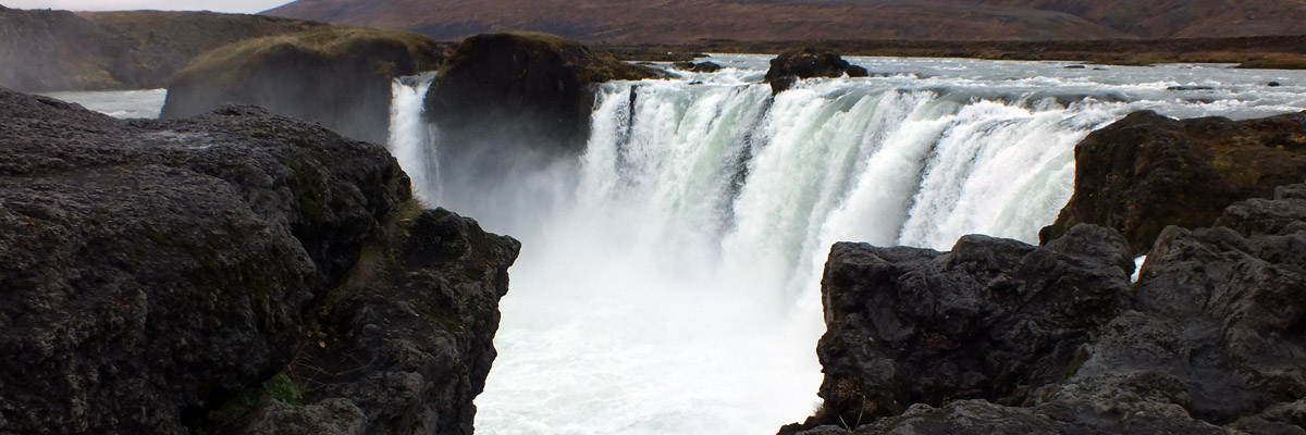
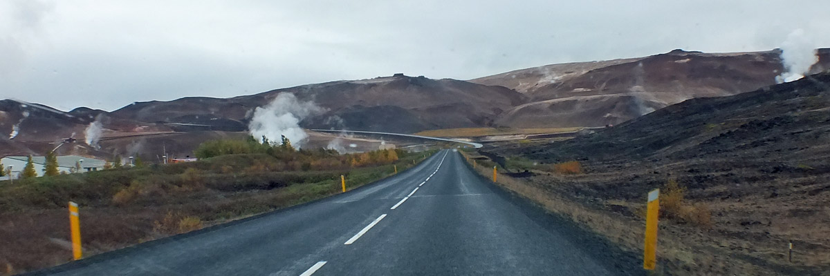
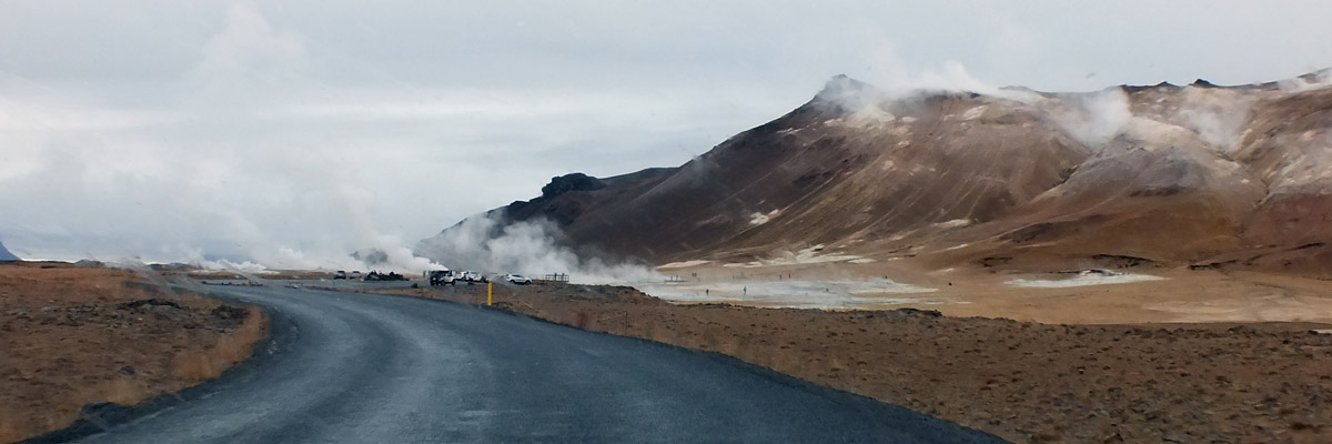
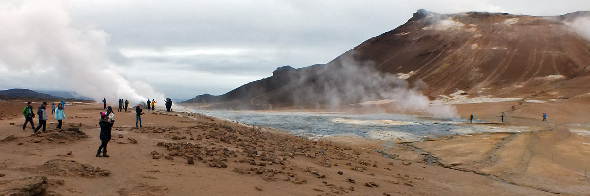
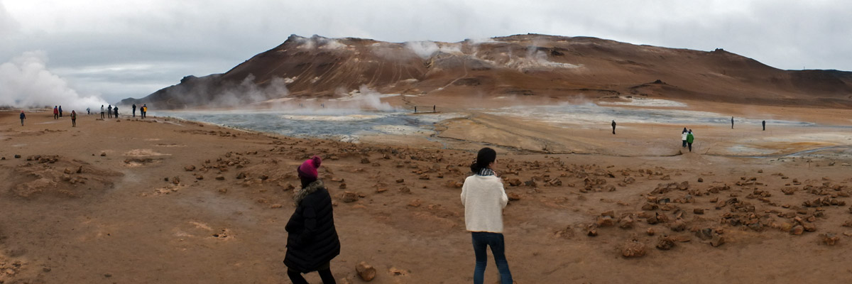
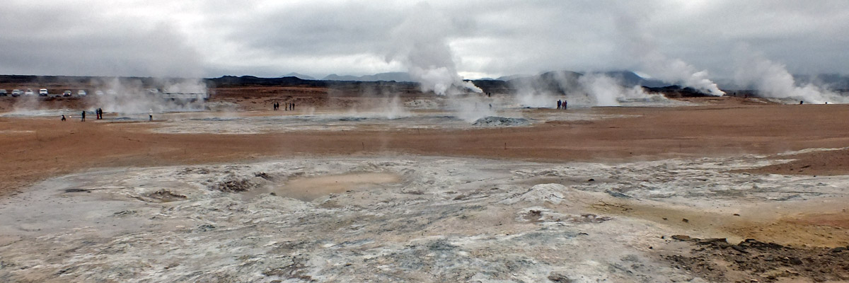
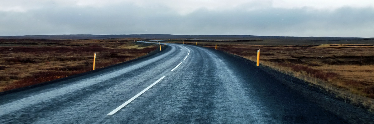
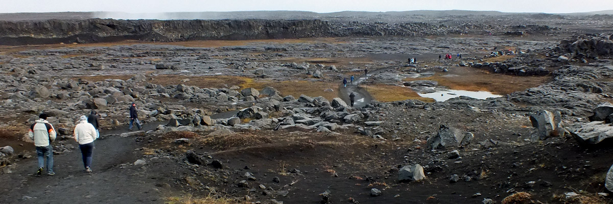
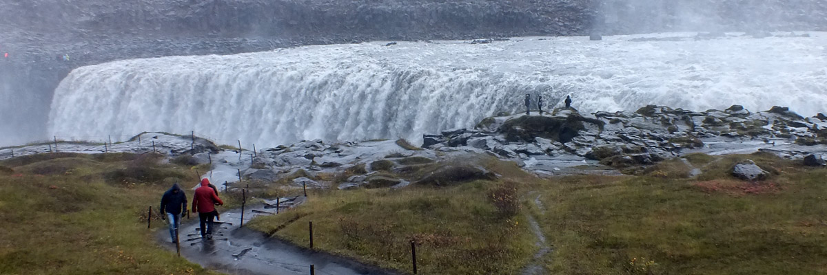
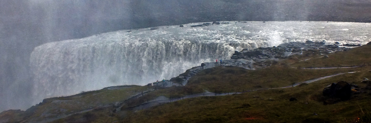
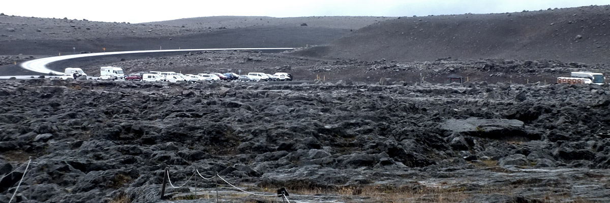
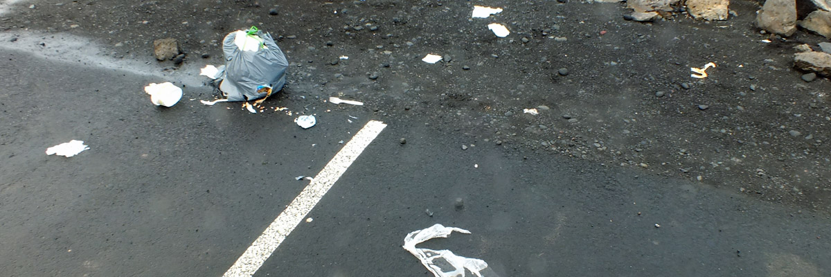
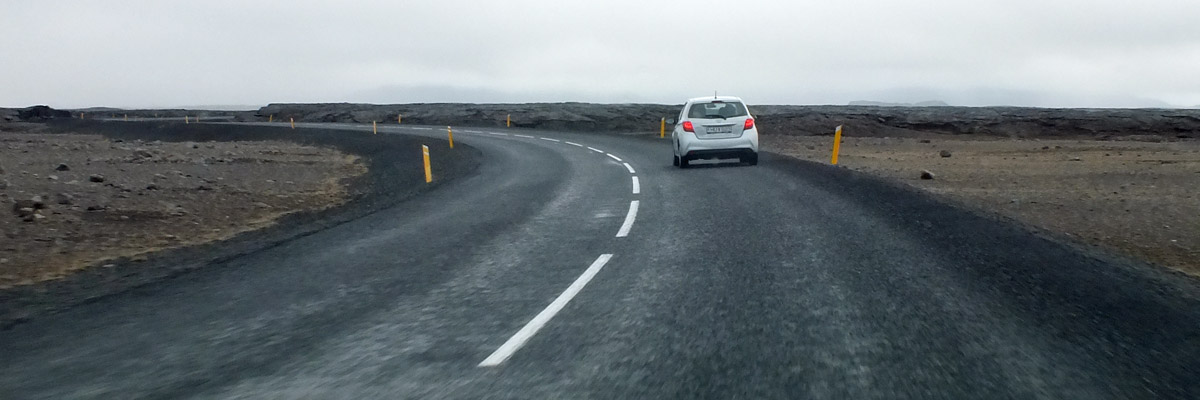
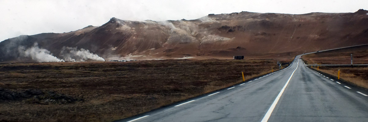
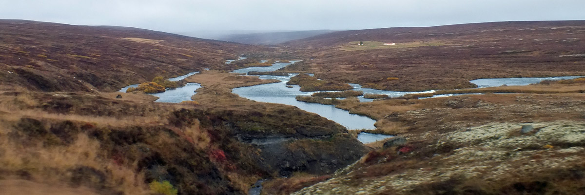
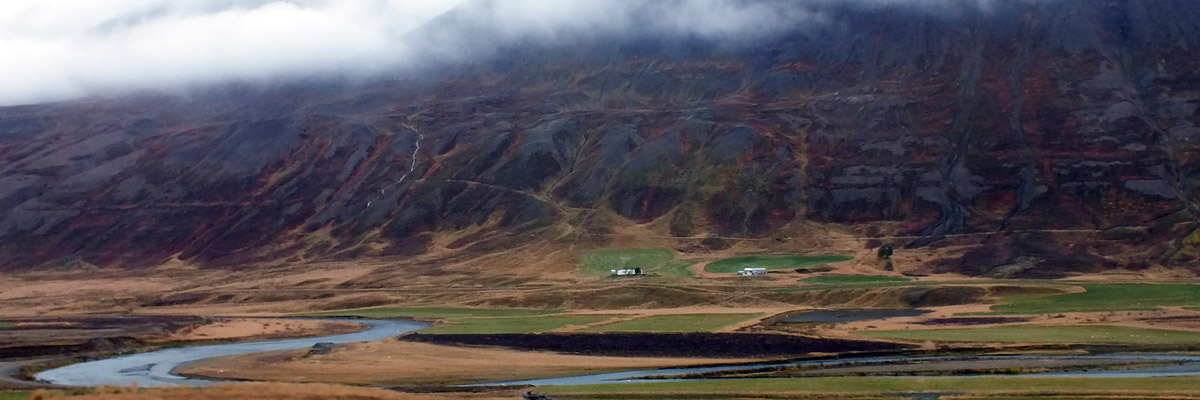
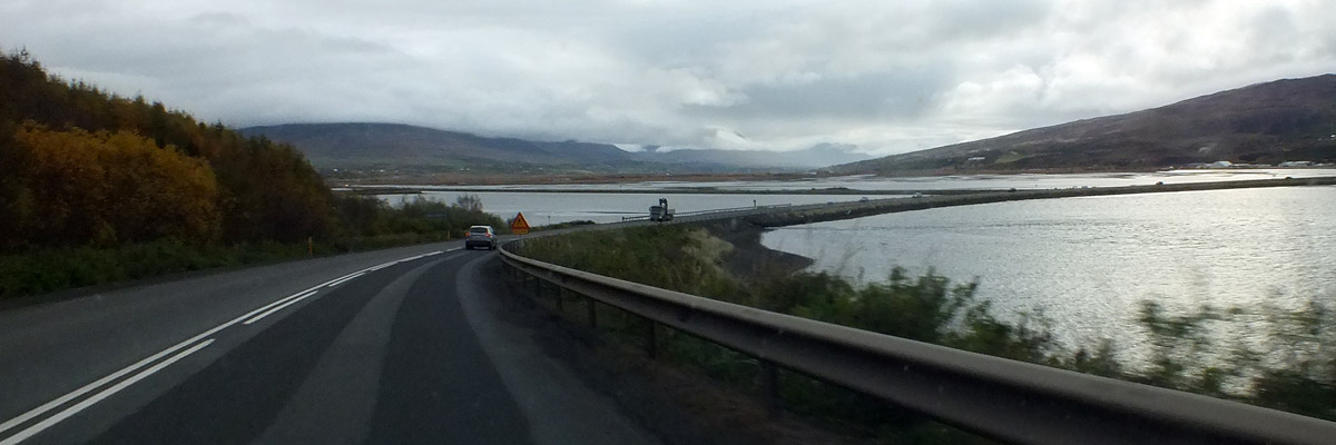
Our original plan for today was to hang around Akureyri, but we will instead visit some sites to the east, which we would have seen on our way to Egilsstaðir tomorrow. We drive south out of town, around the head of the fjord, then north to loop around the ridge of mountain to the east. A tunnel, Vaðlaheiðargöng, is expected to open next year, cutting off this northern loop. The project appears to be something of a white elephant. It's two years behind schedule and well over budget, due to some unforeseen technical problems. It will shorten the trip east by a mere ten miles, and replace a stretch of good road over a pass that is not particularly high or treacherous. The beneficiaries of all this are the 2,000 residents of Húsavík, a fishing town to the northeast, who will gain more reliable winter road access to Akureyri. No one else seems to think it's worth the cost. Forty minutes out of town, we arrive at Goðafoss, a graceful curve of a waterfall with a couple of big knuckles in the middle, on the river Skjálfandafljót. In about the year 1000, the Alþingi, under the guidance of the lawspeaker Thorgeir Thorkelsson, decided that Iceland should convert to Christianity. Legend has it that Thorgeir, who was chieftain in this region, threw his pagan idols into the falls here on his return from Þingvellir. Thus it is Goðafoss, the Falls of the Gods. There are car parks on both sides of the river, each with about twenty cars in it; getting photos without tourists in them is a challenge. Another forty minutes along, we pass Mývatn, Iceland's third-largest natural lake. Mývatn is a mere 2300 years old, formed in the wake of volcanic activity (see Wikipedia for more detail, if you're interested), but the peculiar ecology and geology of the lake and its surroundings led to the creation of the Mývatn- Laxá Nature Conservation Area, nominated as a UNESCO World Heritage Site. Notably, it is a nesting area for a large variety of aquatic birds. Marc and I take note of a new hotel and other development along the Ring Road here, an indication of the lake's popularity with outdoor enthusiasts. I've read that the government is becoming increasingly concerned about attendant environmental stress. We do our bit to reduce such stress by just driving by. A few miles on, the road passes over the barren ridge of Námafjall. On the other side is a parking area for Hverir, a zone of geothermal activity with fumaroles (steam vents) fuming and mudpots blurping. The air is thick with the stench of hydrogen sulfide, not merely sulphuric but intensely acrid, the reason nothing grows here. The landscape is often compared to Mars, but I'm thinking more of Io, Jupiter's volcanic moon--bizarre and alien, in any case. We spend a half an hour wandering about. There is enough space here that for once I don't much mind sharing it with dozens of my fellow tourists. We drive another twelve miles along the Ring Road, then turn north on the 862, which follows the west bank of the river Jökulsá á Fjöllum, Iceland's second- longest. This broad, shallow valley is, in places, the most truly moon-like landscape I've seen, gray and barren. We are soon at the parking area for Dettifoss, Iceland's largest waterfall by volume, and reputedly Europe's most powerful (a function of volume and drop). There are, of course, thirty cars and a bus here. Our fellow tourists are strung out along a half-mile trail to the falls, and a side trail to Selfoss, a half-mile above. (A third waterfall, Hafragilsfoss, is a mile below Dettifoss.) I can see another fifteen or twenty cars in the car park across the gorge. Win and I viewed the falls from that side in 1999--the west road was paved only a few years ago. Truth to tell, the view was better from over there. The angle of the falls causes the mist to rise in our faces over here. Back in the car park, in an area designated for campers, I pass by a dumped bag of trash, split open and scattered. Up until now, I have been feeling mildly bummed out by the little tourist hordes we've encountered, not really big crowds but more than I was expecting this late in the season. Now I am disgusted, and feeling that I don't want to be part of this problem anymore. We were planning to continue north on the 862 to the coast, looping back toward Akureyri via Húsavík. The map I am using--yes, a paper map, call me a Luddite--shows the road as high grade all the way through. Apparently the map's publishers have jumped the gun--a large sign warns that it is, as yet, a four- wheel-drive track beyond the car park. We might loop around to the other side of the river, but it's quite a long loop--an hour and a half just to the viewpoint on the other side, where we would no doubt kill another half an hour. We don't want to get back late, so decide to return to Akureyri the way we came. On the way out to the Ring Road, we pass four more buses coming in. We're back late in the afternoon. I have time to explore some of the upper town, in the vicinity of Akureyri Junior College, one of Iceland's oldest educational institutions. The walkway between the college and downtown has a dual designation, The Road To Education on the way up, The Road To Destruction on the way down. Destruction follows close of class Friday. We have a pint at R5, then dine at Rub 23, a highly recommended restaurant right across the street from our apartment. [As I edit this long after the fact, I can't remember what I ate, or whether it was any good. That might say more about me than about the restaurant.] Check out Ölstofa Akureyrar, another local beer pub a couple doors up the street, before calling it a night. Next |
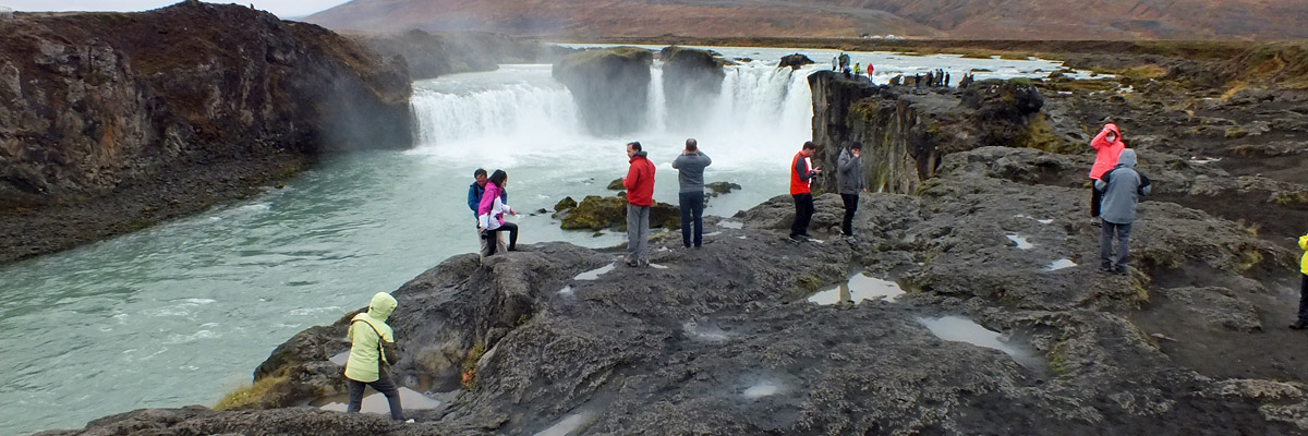 |
Tourists At Goðafoss
 |
I pushed them in
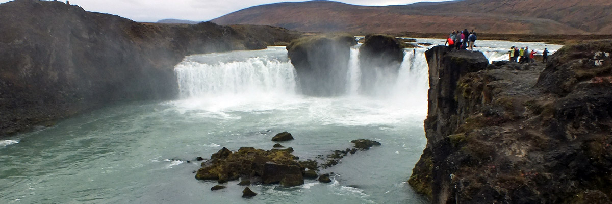 |
Goðafoss
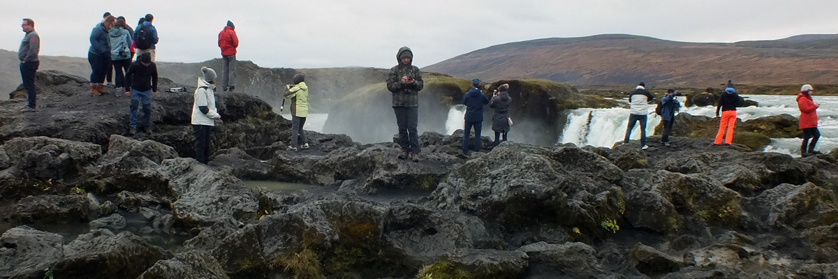 |
More Bloody Tourists
 |
I pushed them in, too
 |
Some of them crawled back out
 |
So I pushed them back in
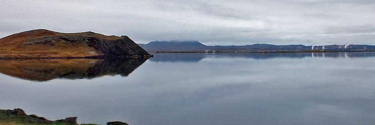 |
Mývatn
 |
Námafjall
 |
Hverir
 |
Hverir
 |
Hverir
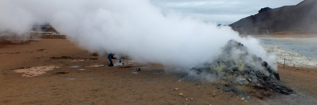 |
Fumarole
 |
Hverir
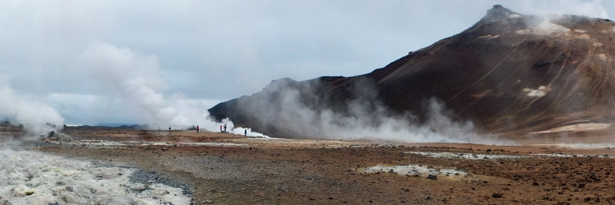 |
Hverir
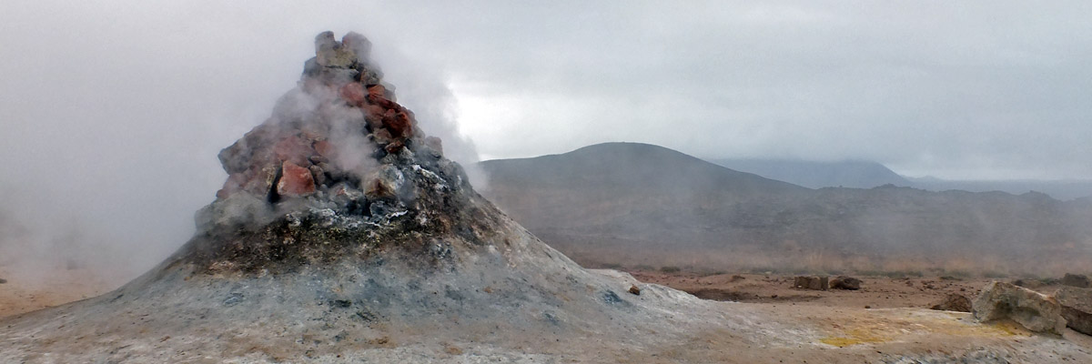 |
Fumarole
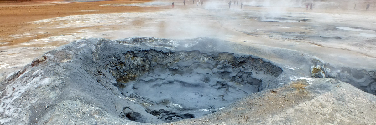 |
Mudpot
 |
Hverir
 |
Flat
 |
Pilgrimage To Dettifoss
 |
Dettifoss
 |
Close To The Edge
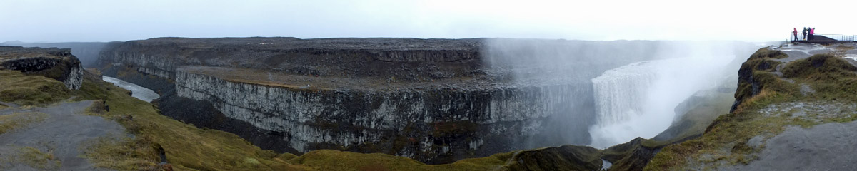 |
Panoramic View
 |
Dettifoss
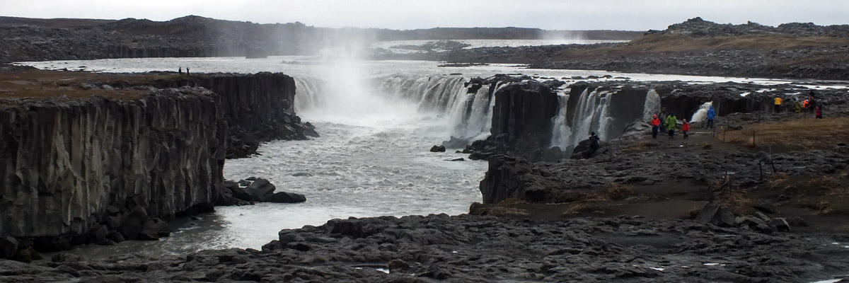 |
Selfoss
 |
Too many to push in
 |
Bloody Tourists
 |
Road Back
 |
Námafjall
 |
Near Mývatn
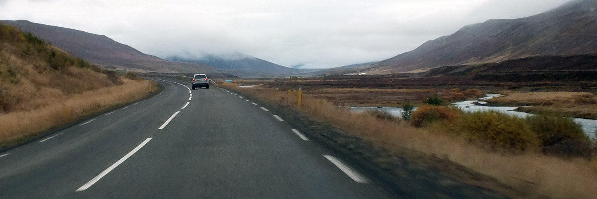 |
Ljósavatnsskarð
or thereabouts
 |
Ljósavatnsskarð
maybe
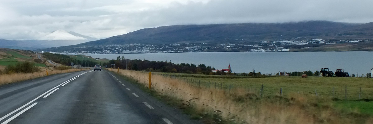 |
Akureyri
 |
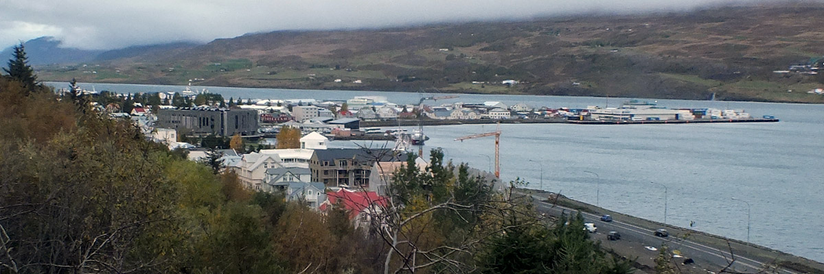
Approaching Akureyri
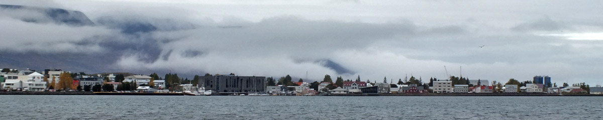 |
Akureyri
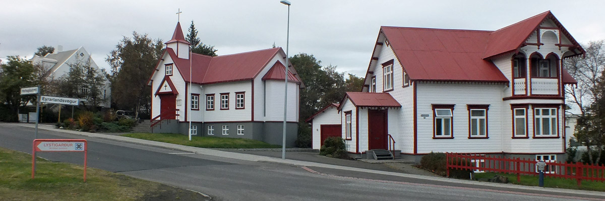 |
Uptown
 |
Akureyri
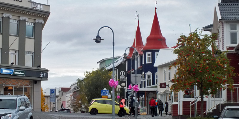 |
Downtown
where all the lights are bright
Day Out From Akureyri
Next
| September | /October/ | November |
| S | M | T | W | T | F | S |
| 24 | 25 | 26 | 27 | 28 | 29 | 30 |
| 1 | 2 | 3 | 4 | 5 | 6 | 7 |
| 8 | 9 | 10 | 11 | 12 | 13 | 14 |
| 15 | 16 | 17 | 18 | 19 | 20 | 21 |
| 22 | 23 | 24 | 25 | 26 | 27 | 28 |
| 29 | 30 | 31 | 1 |
The North Atlantic Arc Home
Mr Tattie Heid's Mileage
Results may vary