Falling Tide Fading Light
15 September 2025
The North Atlantic Arc Home
| September |
| S | M | T | W | T | F | S |
| 13 | ||||||
| 14 | 15 | 16 | 17 | 18 | 19 | 20 |
| 21 | 22 | 23 | 24 | 25 | 26 | 27 |
| 28 |
 |
|
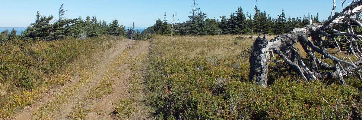
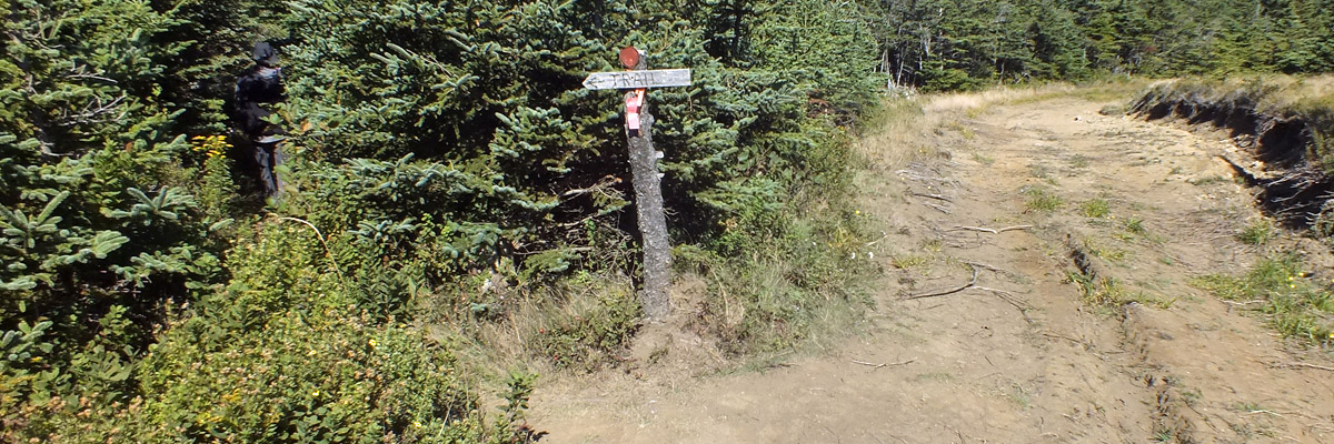
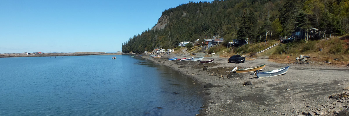
Monday 15 September 2025--In the wake of the American Revolution, sovereignty over Grand Manan, the islands in Passamaquoddy Bay (including Campobello and Deer Island), and a few others in the region was open to question. The 1794 Jay Treaty defined the border, and most of the lingering ambiguities of language and geography were addressed by the Treaty of Ghent, following the War of 1812. Somehow, the matter of tiny Machias Seal Island, twelve miles southwest of Grand Manan, and the waters around it, remains unresolved to this day. The most serious consequence of this is a certain amount of hostility between the lobster boats fishing out of Maine and New Brunswick, whose jurisdictions have different approaches to conservation: Maine limits total catch, and New Brunswick closes the fishery during the summer spawning and molting season. (Having been fed several soft-shell lobsters, which are essentially undersized lobsters in yet-unhardened larger shells, in August in Maine, I tend to side with the Canucks.) The Brits put a light on Machias Seal in 1832--two, in fact, to act as range lights. The current light, built in 1915, was automated more than thirty years ago, but is still manned, one of the few such in Canada, for purposes of asserting sovereignty. The island was designated a migratory bird sanctuary in 1944. A limited number of puffin-viewing trips are allowed in season, from both countries: Bold Coast Charter Company out of Cutler Harbor, Maine, and Sea Watch Tours, in Seal Harbour, where we are staying. As the self-proclaimed chronicler of the North Atlantic Arc, I'm slightly embarrassed that I have never seen puffins in the wild. I'm not going to now, either--the season ended at the end of July. I travel in the wrong months. Off we go to explore Grand Manan instead. Route 776 runs down the east coast of the island, the population of 2500 or so strung out along the way, in the villages of North Head, Grand Harbour, and Seal Cove, and a few other hamlets. We drive to the southern end of the road, park, and have a look at the Southwest Head Light, a rectangular box that isn't particularly picturesque. Up a trail along the western coast, we view the hundred-meter cliffs, composed of volcanic basalt. The columns are not so pleasingly regular as many I've seen. There is the stub of an outlier that was called the Southern Cross, which was strikingly cruciform before it collapsed in 1976. Back north we go, through Seal Cove and Grand Harbour, then west along the one road that crosses the island from east to west. At the end of the road is Dark Harbour, where a handful of cottages look over the harbor itself, guarded by a natural seawall. According to Dark Harbour Dulse, 95% of the world's dulse is harvested here. Dulse (Palmaria palmata) is a seaweed common across the North Atlantic, used as both food--apparently popular in Iceland--and fertilizer. The dulse harvest and fishing were traditionally the twin pillars of the Grand Manan economy; there are still drying yards to be seen around, and large sacks of it for sale, not to mention smaller snack bags in the groceries and convenience stores. I suppose the high Fundy tides, and the boulder-strewn intertidal zone, make it easy to harvest here, or at least easier than elsewhere. We are contemplating this when we are approached by an old gent named Johnny Spicer, who sets in to gabbing at us. He tells us how he started harvesting dulse as a child, and made a living at it through much of his adult life. One thing I've learned in my years of traveling is if a local old guy starts gabbing at you, let him gab away--you'll learn a lot. Johnny keeps us occupied for a good long while. Johnny also tells us that if we ever come to Dark Harbour when the tide is coming in, not to park down close to shore. Even out here in the lower Bay of Fundy, the tide is extreme, and comes in fast. Back across the island we go, then north to see the Long Eddy Point Light. The lighthouse at West Quoddy Head is visible across the water, eight miles away. We've been the length of Grand Manan now, fifteen straight-line miles from tip to tip, about twenty by road. On our way back south, we stop at the island's one major grocery for supplies. Your Independent Grocer is, perhaps paradoxically, a Canadian chain; I guess it's franchised, with each independent operator named on the sign. Ahmet's seems to me to be better stocked than Jeffery's in St George. As well as a full range of groceries, there is a good selection of craft beer from New Brunswick and the other Maritime provinces. We stop for dinner at the Harbour Grille & Gift House in Grand Harbour. It's an informal place that does basic grille items, along with fish and chips and the like. Scallops for me. Then back to the house for an evening of beer and CBC news. It might be nice to sit out on the deck, if we had one, to watch the light fading over Seal Cove. Next |
Around Grand Manan
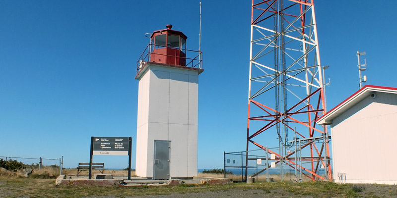 |
Southwest Head Light
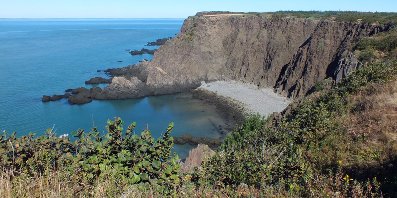 |
Cliffs
 |
Trail
 |
Tango
 |
Trail
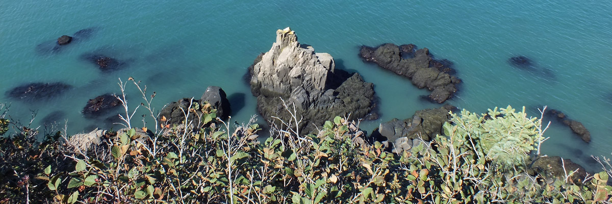 |
Southern Cross
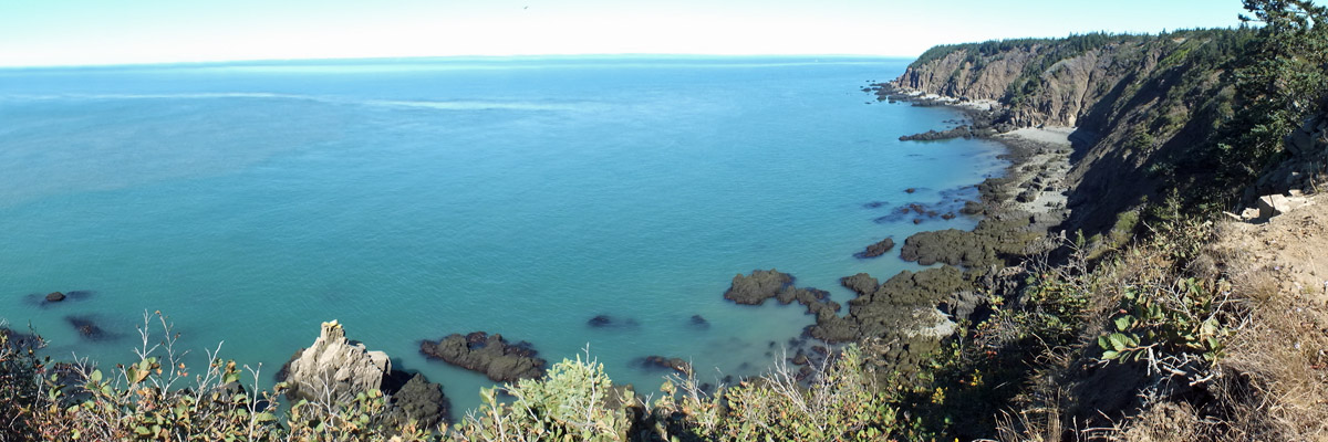 |
More Cliffs
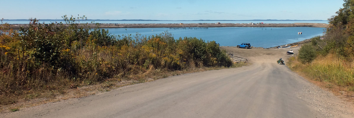 |
Dark Harbour
 |
Dark Harbour
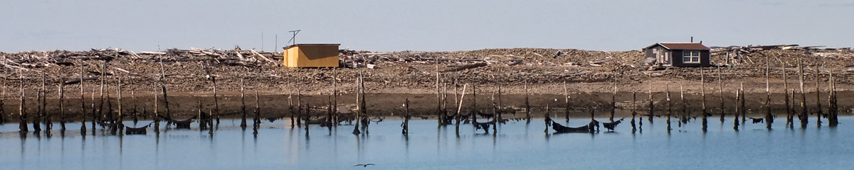 |
Dark Harbour
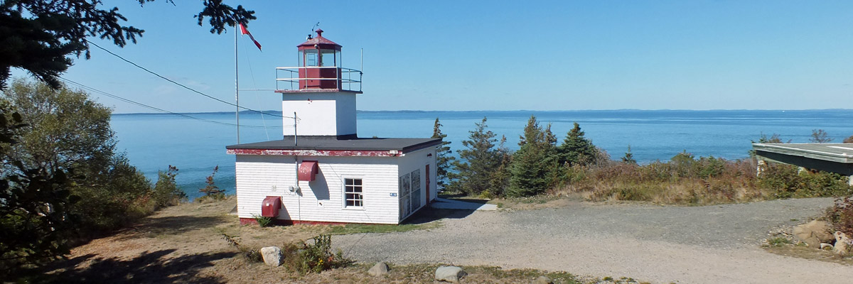 |
Long Eddy Point Light
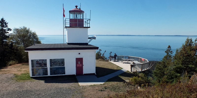 |
Long Eddy Point Light
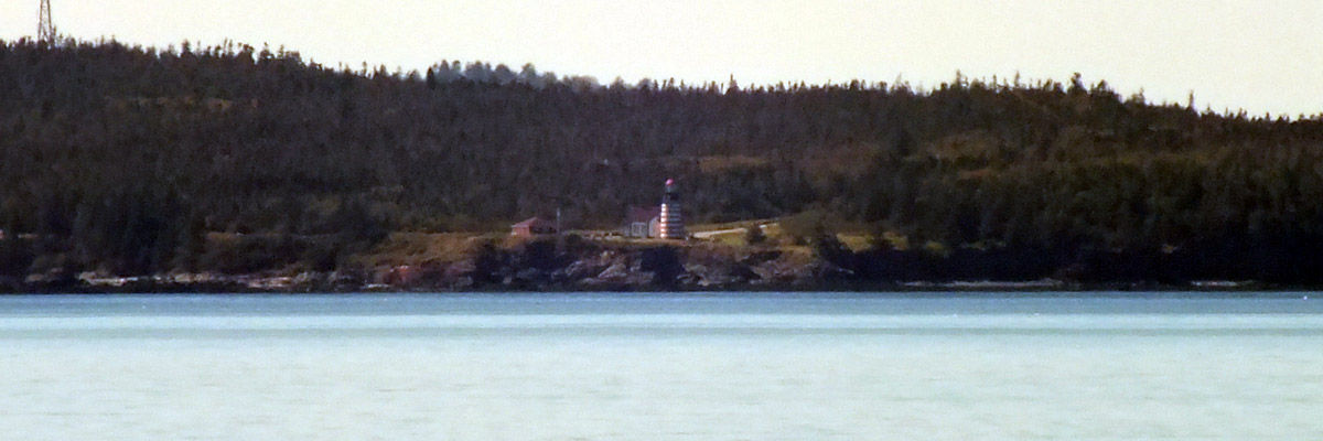 |
West Quoddy Head
Next
| September |
| S | M | T | W | T | F | S |
| 13 | ||||||
| 14 | 15 | 16 | 17 | 18 | 19 | 20 |
| 21 | 22 | 23 | 24 | 25 | 26 | 27 |
| 28 |
The North Atlantic Arc Home
Mr Tattie Heid's Mileage
Results may vary
MrTattieHeid1954@gmail.com