from the Gulf of St Lawrence to the Sea of the Hebrides

28 August 2012
The North Atlantic Arc Home
| .August. | September | .October. |
| S | M | T | W | T | F | S |
| 24 | 25 | |||||
| 26 | 27 | 28 | 29 | 30 | 31 | 1 |
| 2 | 3 | 4 | 5 | 6 | 7 | 8 |
| 9 | 10 | 11 | 12 | |||
| 4 | 5 | 6 | ||||
| 7 | 8 | 9 | 10 | 11 | 12 | 13 |
| 14 | 15 | 16 | 17 | 18 | 19 | 20 |
| 21 | 22 | 23 | 24 | 25 | 26 | 27 |
| 28 | 29 | 30 |
 |
|
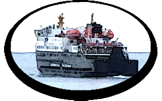
Tuesday 28 August 2012--Gray morning. I'm up early, meaning to catch the 8:25 ferry. The Toronto couple are having breakfast as I
pass through the dining area. They report having seen no whales yesterday. Bummer.
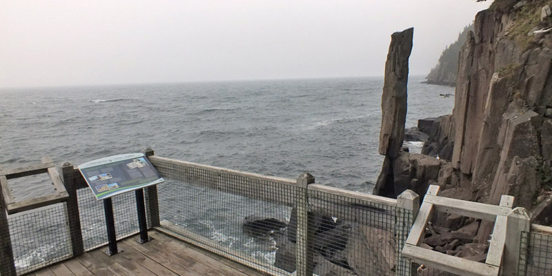
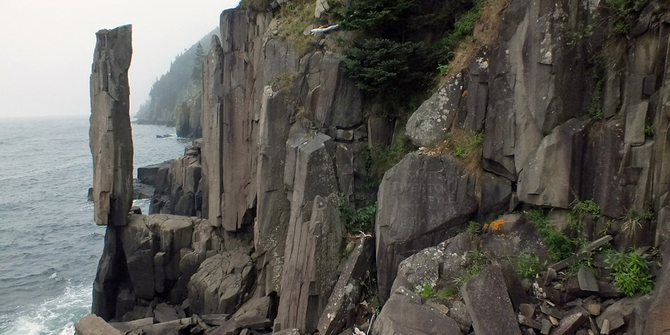
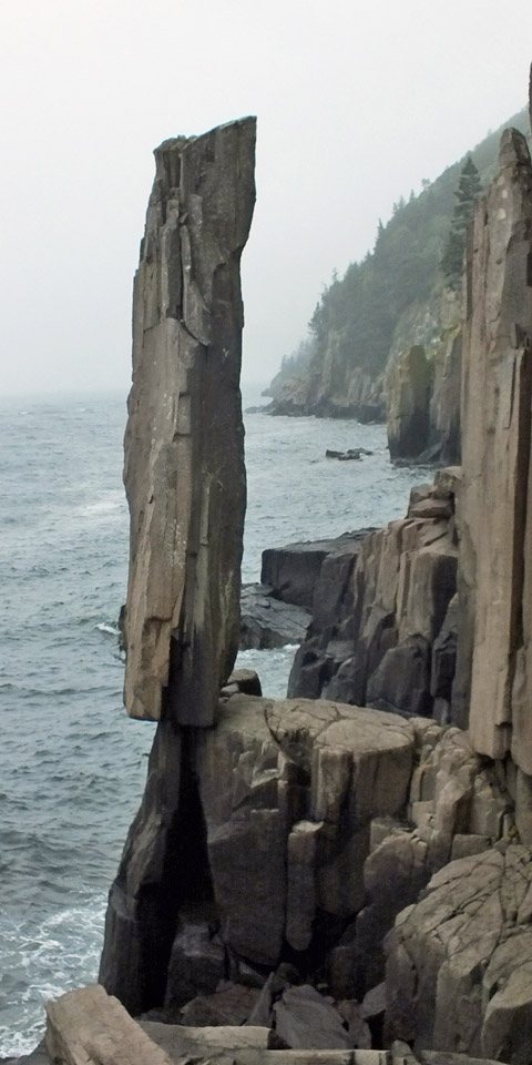
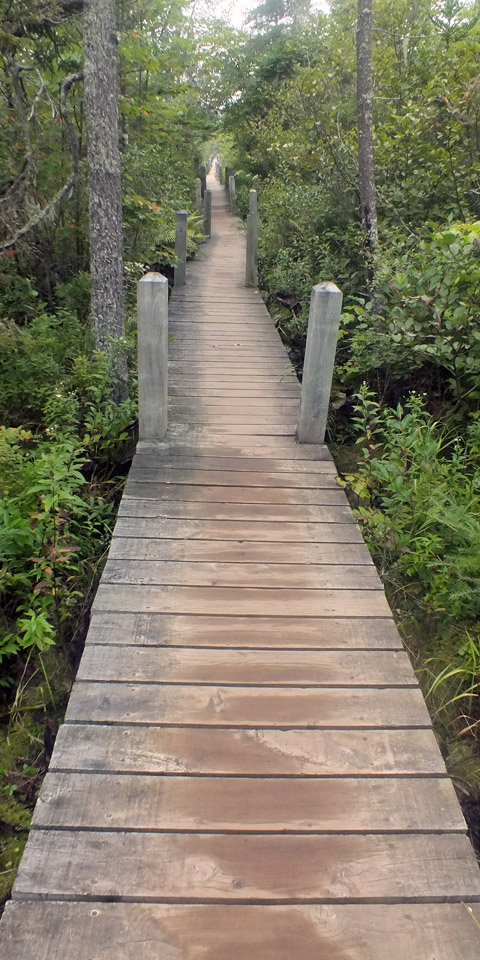
The ferry carries me across Grand Passage to Long Island. About ten minutes along the road, I park at the trailhead for the path to Balancing Rock. The trail is fairly straight and level for half a mile or so, passing through woods and over bogs. Then a wooden stair of 247 steps descends to a viewing platform at the water's edge. The cliffs here are what is called columnar basalt, on the whole not so pleasingly regular as the hexagonal columns one might see at the Devil's Causeway in Northern Ireland, or Fingal's Cave in Scotland, or any number of other places. But the one outstanding column, the Balancing Rock itself, is pretty amazing. The signboard at the platform says it's twenty feet tall, although it looks more like thirty to me, the length of a small bus. It also looks as though you could walk up to it and push it right over. It's been tried...you can't. I make the crossing of Petit Passage to Digby Neck and, on the way to Digby, make a side trip to Gulliver's Cove, a quiet spot said to have been the lair of local pirate Cut Throat Gulliver. Gulliver's wife was a West Indian woman who didn't much care for the Nova Scotia climate. It seems that she murdered him, and took his boat and crew back to the Caribbean. From there, I wander some sketchy back roads through the village of Culloden, thankful that it isn't possible to get too lost on the Neck. Just outside Digby, I have a late breakfast at Josie's Place. Then it's off to Lunenburg, on the Atlantic coast. I've driven across Nova Scotia's southwestern peninsula several times, and it always seems strange. To the tourist, the province is all about coastlines. The interior is mostly scrubby woods, dotted with rough and stony agricultural land. The route I take, coincident for a long stretch with that walked by Margaret Davis, passes through the scattered settlement of Springfield, namesake of my hometown. It sits on a ridge looking over lake-dotted valleys which are surely among the more picturesque parts of the interior. The town center, if it can be called that, is defined by a rustic automotive garage and a post office that is but a room at the front of someone's house. I stop to mail a couple of postcards. Another dozen miles along, New Germany is a real town, with restaurants and shops that rarely see tourists, I'll bet. I'm tempted to stop, but keep moving. Arrive in Lunenburg at 4:30, after enduring a traffic bottleneck in Bridgewater (and stopping at Canadian Tire for supplies). Find my room, one street up from the waterfront, and catch up on email and such--there was no wifi on Brier Island. I haven't missed much. The sun breaks through as I stroll around town. Dinner is at the Grand Banker, downstairs from my room. Good food, and pints of Propellor Bitter, a microbrew from Halifax. No complaints this evening. Next |
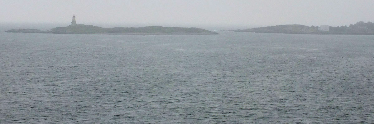 |
Leaving Brier Island
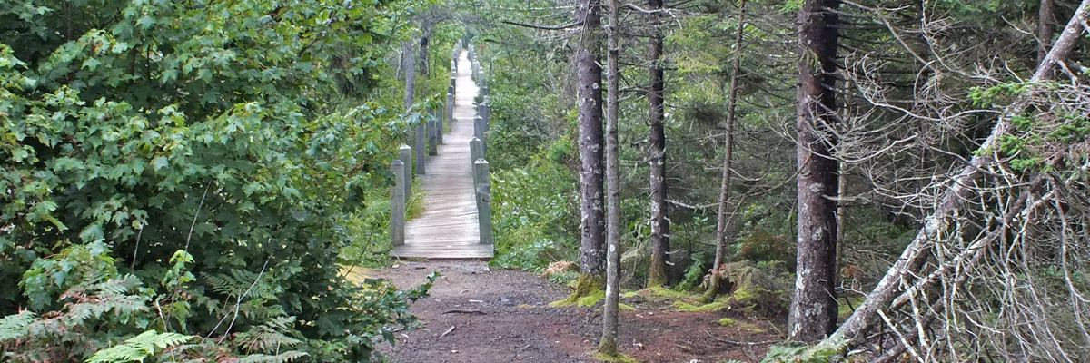 |
Trail To Balancing Rock
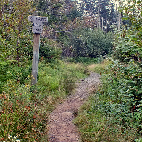 |
Trail To Balancing Rock
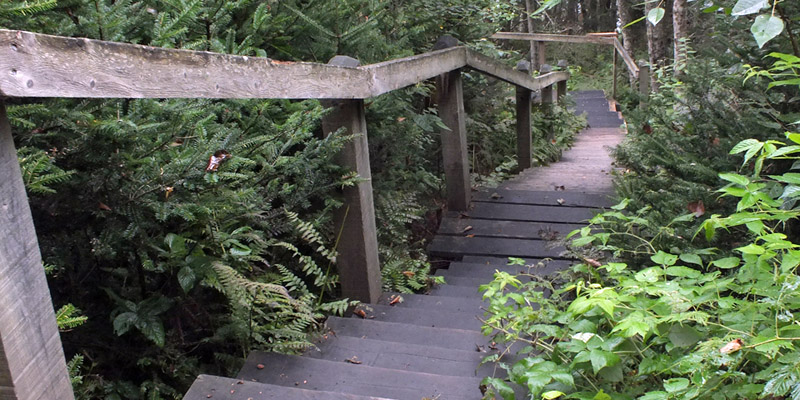 |
Trail To Balancing Rock
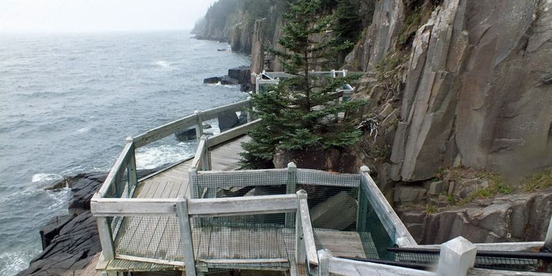 |
Balancing Rock
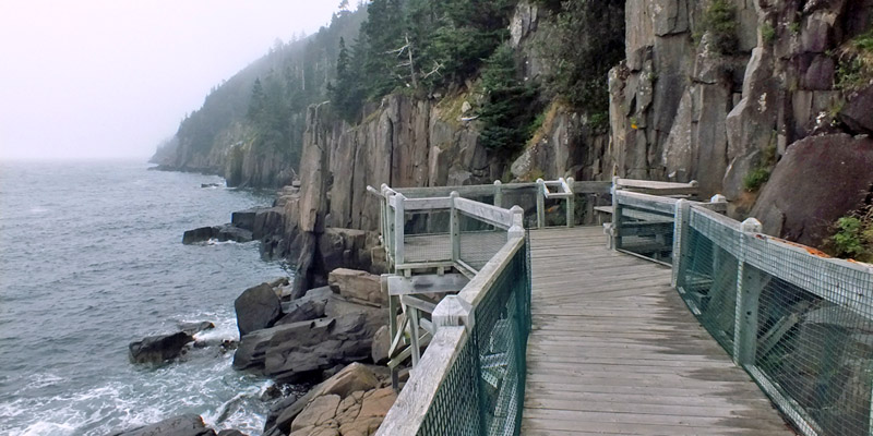 |
Balancing Rock
 |
Balancing Rock
 |
Balancing Rock
 |
Balancing Rock
 |
Trail From Balancing Rock
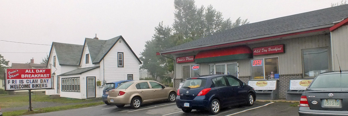 |
Josie's Place
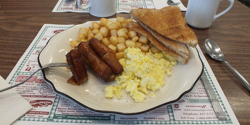 |
Breakfast
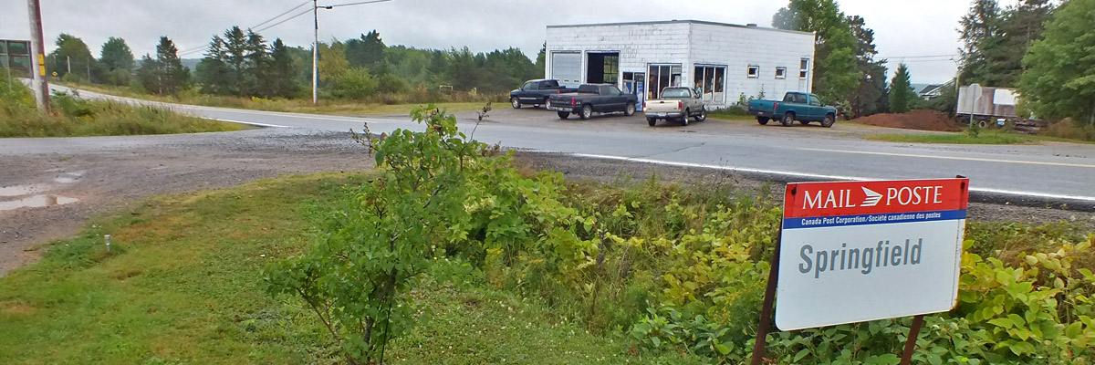 |
Beautiful Downtown Springfield
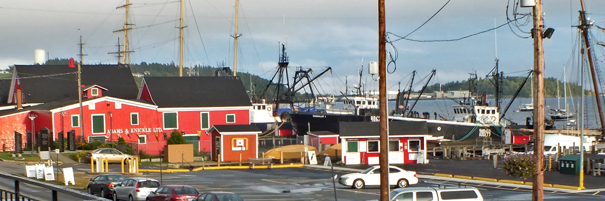 |
The Late Afernoon Sun Illuminates Adams & Knickle Ltd
 |
The Grand Banker
Today's Route
Next
| .August. | September | .October. |
| S | M | T | W | T | F | S |
| 24 | 25 | |||||
| 26 | 27 | 28 | 29 | 30 | 31 | 1 |
| 2 | 3 | 4 | 5 | 6 | 7 | 8 |
| 9 | 10 | 11 | 12 | |||
| 4 | 5 | 6 | ||||
| 7 | 8 | 9 | 10 | 11 | 12 | 13 |
| 14 | 15 | 16 | 17 | 18 | 19 | 20 |
| 21 | 22 | 23 | 24 | 25 | 26 | 27 |
| 28 | 29 | 30 |
The North Atlantic Arc Home
Mr Tattie Heid's Mileage
Results may vary
MrTattieHeid1954@gmail.com