from the Gulf of St Lawrence to the Sea of the Hebrides

9 September 2012
The North Atlantic Arc Home
| .August. | September | .October. |
| S | M | T | W | T | F | S |
| 24 | 25 | |||||
| 26 | 27 | 28 | 29 | 30 | 31 | 1 |
| 2 | 3 | 4 | 5 | 6 | 7 | 8 |
| 9 | 10 | 11 | 12 | |||
| 4 | 5 | 6 | ||||
| 7 | 8 | 9 | 10 | 11 | 12 | 13 |
| 14 | 15 | 16 | 17 | 18 | 19 | 20 |
| 21 | 22 | 23 | 24 | 25 | 26 | 27 |
| 28 | 29 | 30 |
 |
|
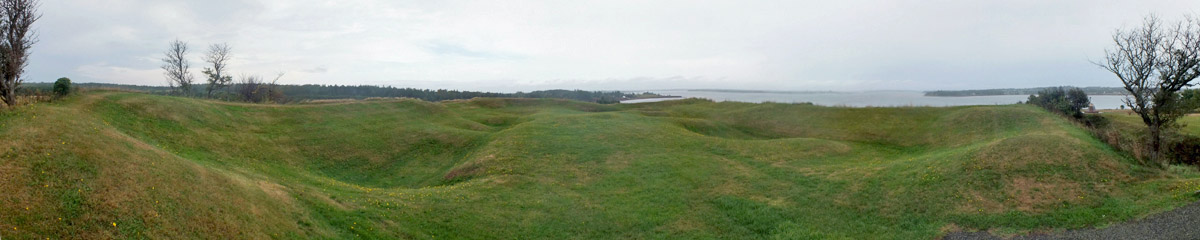
Sunday 9 September 2012--It's about two miles on a straight line from Charlottetown to Port-la-Joye--Fort Amherst National Historic Site,
guarding the mouth of Charlottetown's harbor. It takes a half an hour to get there by road, looping around the fingers of the North and West Rivers.
(These are not truly rivers--PEI isn't big enough to support any--but extensions of Charlottetown Harbour.) In 1720, the French built Port-la-Joye, a
fort that served as the administrative center for what they called Île St-Jean. The fort was subordinate to the fortress at Louisbourg, on Île Royale
(now Cape Breton Island), and its fortunes followed its parent's. After Louisbourg fell to a makeshift army of New Englanders in 1745, during King
George's War (the War of the Austrian Succession in Europe), Port-la-Joye was taken by the British, and taken back by the French. Following Louisbourg's
final fall in 1758, during the French and Indian War, la Joye passed into British hands for good. The fort was entirely rebuilt and named Fort
Amherst, and then abandoned in 1770, as fortifications were improved closer to town. The remaining earthworks here are from that last British
construction. One gets a sense here of what the approach to Charlottetown by sea is like, and what a marvelously sheltered harbor it is.
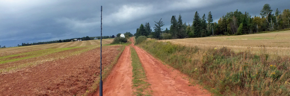
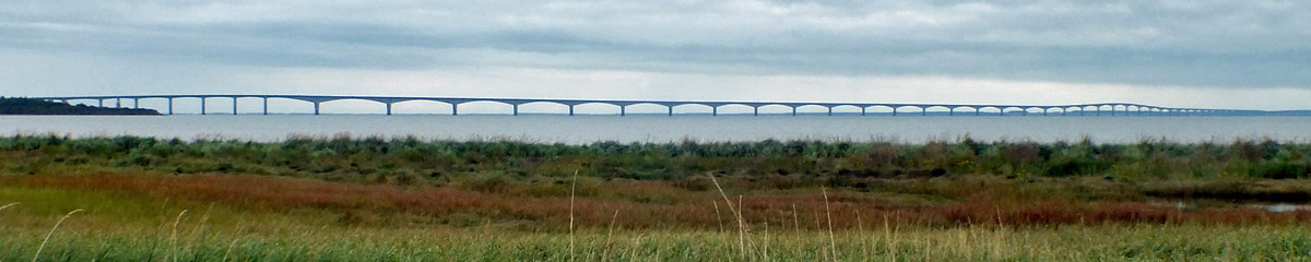
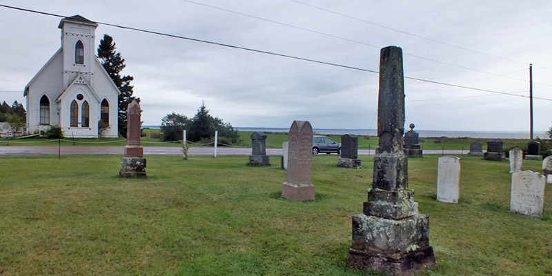
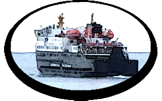
I drive the slower routes along the shore of the Northumbrian Strait under darkening skies. At Borden, near the approach to the Confederation Bridge, there is a retail village that is the first thing encountered by tourists crossing from New Brunswick. It's lunchtime, and I'm thinking there will be someplace good to eat here. I'm partly right--there's a place to eat. It's raining buckets now. The rain slackens a bit as I pay my toll and drive up onto the bridge. It's an amazing work, at eight miles the longest bridge in the world over water that freezes. When PEI entered confederation, it was written into the Canadian constitution that the federal government had to guarantee transport to and from the island, specifically steamship service. Talk of a "fixed link" started not long after--bridge, tunnel, causeway, or some combination thereof. This particular bridge was approved in the '80s (a constitutional amendment was required), and it was completed in the spring of 1997, after three and a half years of construction, at a cost of something over a billion dollars. That's roughly $10,000 for every man, woman, and child on the island. Seven-foot barriers along the side of the roadway restrict both wind exposure and vision to the sides, discouraging gawkers from having head-on collisions with each other. (You get a great view from a tour bus.) The gentle S-curve of the bridge is also a safety feature, meant to mitigate the hypnotic effect of a long straight drive. The crossing takes about twelve minutes. The ferry here took about forty-five, plus waiting time--an hour and a half, at least. The benefits of the bridge have been debated for years before and after it was built. Many islanders felt it would bring an end to a way of life, as PEI ceased to truly be an island. Some years ago, I read a newspaper article lamenting the loss of the social aspects of waiting for the ferry at the Borden terminal, of all things. The bridge has undoubtedly been a boon to the island's fishery and agricultural economy, greatly facilitating transport of potatoes and lobsters. Charlottetown is certainly doing well. But it's a double-edged sword. University Avenue leading west out of town is now lined with big-box stores that never before saw PEI as a viable market--Sears, Walmart, Staples, Home Depot. That surely gives islanders access to goods and services previously unavailable to them, but it has killed small, locally-owned businesses, just as it has elsewhere in North America. Yet, away from the capital, things seem not to have changed so much. Folks just don't have to go to Moncton or Halifax to shop for big items any more. Thus, while more tourists are making the crossing, likely fewer locals are. It's an irony I've seen in other places, notably the Faroe Islands and various isles of Scotland, that good transportation links encourage the residents of remote places to stay home, both day-to-day and over the long term. Better access helps these places thrive. Obvious, I suppose, but it's nice to see it working. In tougher times, easy passage can simply help people to leave. I've seen that, too. On the New Brunswick side, I exit the main highway and stop at the tourist information center to pick up a map. I've been here many times on the bus tours, but never noticed that there's also an interpretive center hidden down a trail out back. It's interesting enough, and also houses a very nice cafeteria, where I have bowl of chowder. Now I know where to get lunch when making the crossing. There's a trail out to the Cape Jourimain lighthouse, but it doesn't seem worthwhile in the rain. The cape is actually two former islands, Jourimain* and Trenholme, linked to the mainland by the road, built in the '60s in advance of a causeway-bridge scheme to PEI that was canceled when it was realized that the tidal rip through the gap in the causeway would be catastrophic. It was a road to nowhere until the bridge was built. Oddly enough, the road caused silting between the islands and the mainland, forming a marsh that is now the Cape Jourimain National Wildlife Area, a major staging area for migrating waterfowl. Go figure. Sometimes we humans manage to do something good entirely by accident, when we're trying really hard to muck things up. I've been up and down the main road through here many times over the years, but have never had the chance to do what I'm going to do now. I follow the coastal road down the east side of the peninsula, and very shortly find the old Bayfield Cemetery. It's full of Allens...my people. Mosquitos feast on my blood as I wander through the stones. The big find here is the marker for George and Letitia Allen, my great-great-great-great grandparents. As significant as this is, it's not my ultimate goal--that lies farther down the road. I stop briefly at Cape Tormentine, site of the former ferry terminal, and continue on down past the Upper Cape Cemetery, full of more Allens, to the village of Baie Verte. "Village" seems a bit generous...there's a village hall here, but not much else. I'm looking for the old cemetery, but it doesn't seem to be anywhere close to the village center. Having been up and down the road and in and out every nook and cranny I can think of, I finally depart from Baie Verte along a side road north of the center, leading to the highway...and there it is, a combined Anglican and United Church burying ground. I set out to search it systematically, from lower right corner to upper right to upper left to lower left, and have just about decided that I'm in the wrong place when I spot a dark stone, unlike any other in the yard, way down in the corner. I feel the goosebumps rising as I come around to the front of it--I'm sure it's what I'm looking for, have been hoping to see for some years now: In Memory of Benjamin Allen Departed this life April 14th 1823, aged 88 years Benjamin Allen, veteran under Amherst and Wolfe of Louisbourg and Québec, progenitor of all the Allens hereabouts, my great-great-great- great-great grandfather and earliest known Allen ancestor. The verse below is illegible after almost two hundred years of weathering, but I know from research that it reads: Remember man as you pass by, As you are now, so once was I, As I am now so you will be, Remember man, you have to die. I take a dozen lousy photos of the headstone in the gray drizzle and stand around a while, not wanting to leave. I've found him...I've found Shy Ben. Next *At one time, Jourimain Island was known as Liff's Island, after its owner Eliphalet Allen, eighth child of Benjamin. |
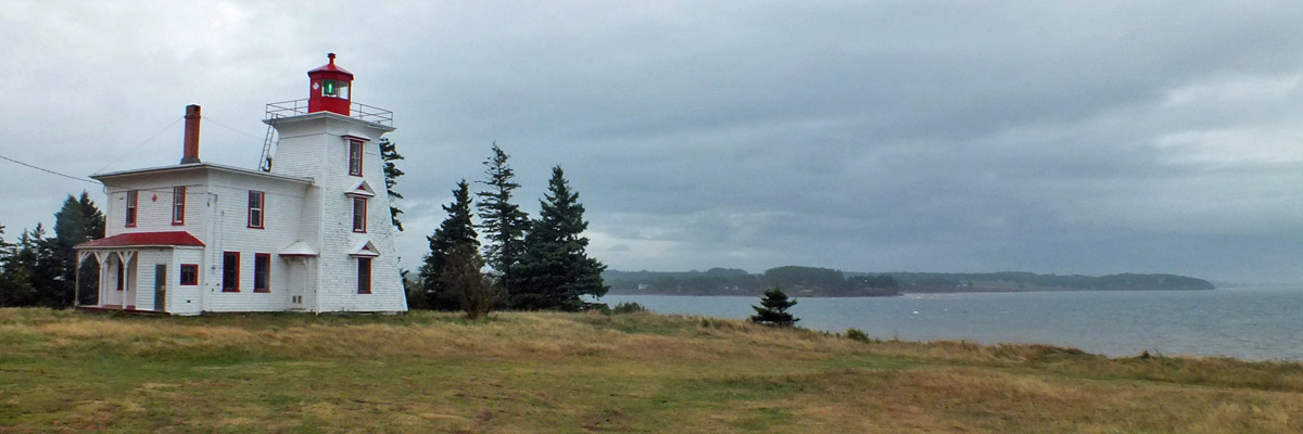 |
Blockhouse Point Light
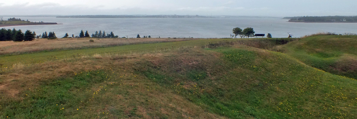 |
Port-la-Joye--Fort Amherst National Historic Site
 |
Port-la-Joye--Fort Amherst National Historic Site
 |
Charlottetown From Fort Amherst
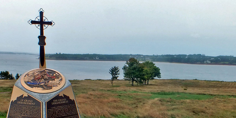 |
Acadian Memorial
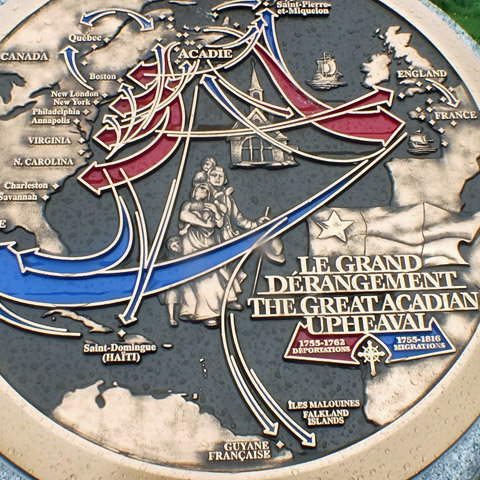 |
Acadian Migrations
 |
Port-la-Joye--Fort Amherst National Historic Site
 |
Out The Moonroof (Forward)
 |
Out The Moonroof (Backward)
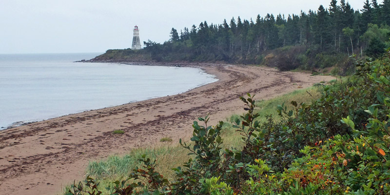 |
Cape Jourimain Light
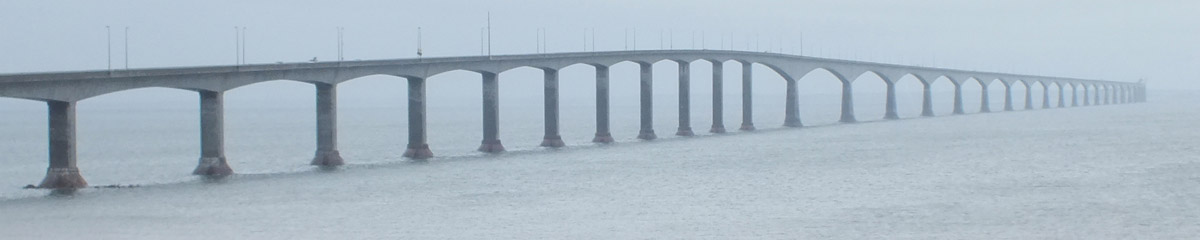 |
Confederation Bridge From Cape Jourimain
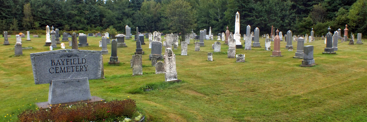 |
Bayfield Cemetery
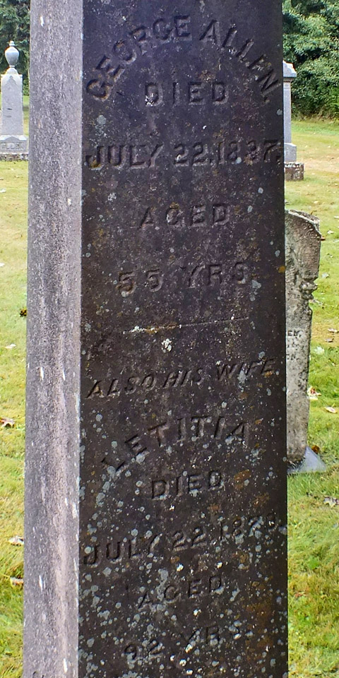 |
George And Letitia Allen
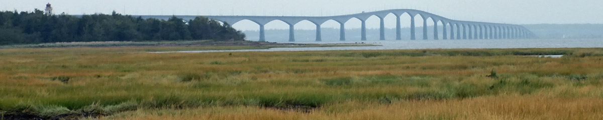 |
Confederation Bridge From Bayfield
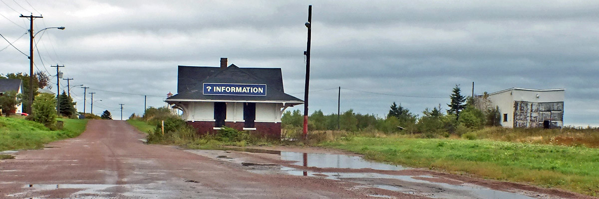 |
Cape Tormentine Tourist Information
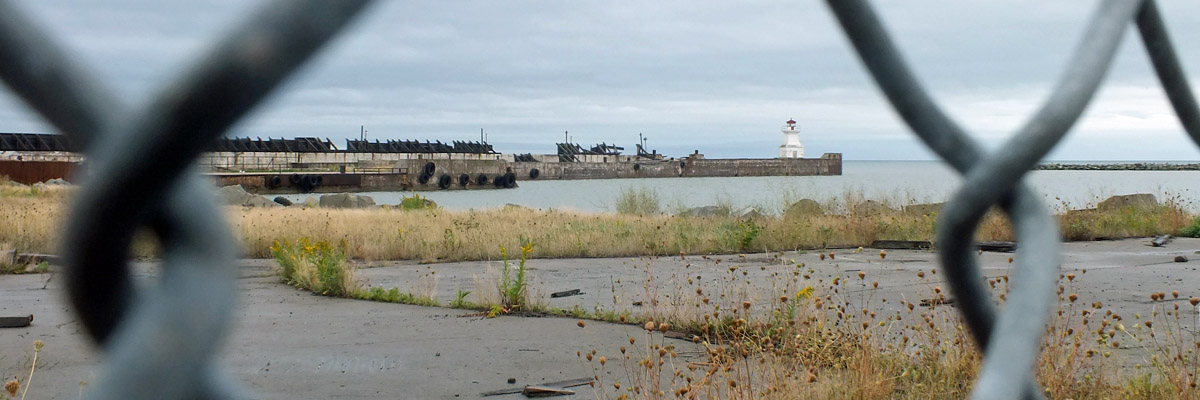 |
Cape Tormentine Ferry Terminal
 |
Confederation Bridge From Cape Tormentine
 |
Upper Cape Cemetery
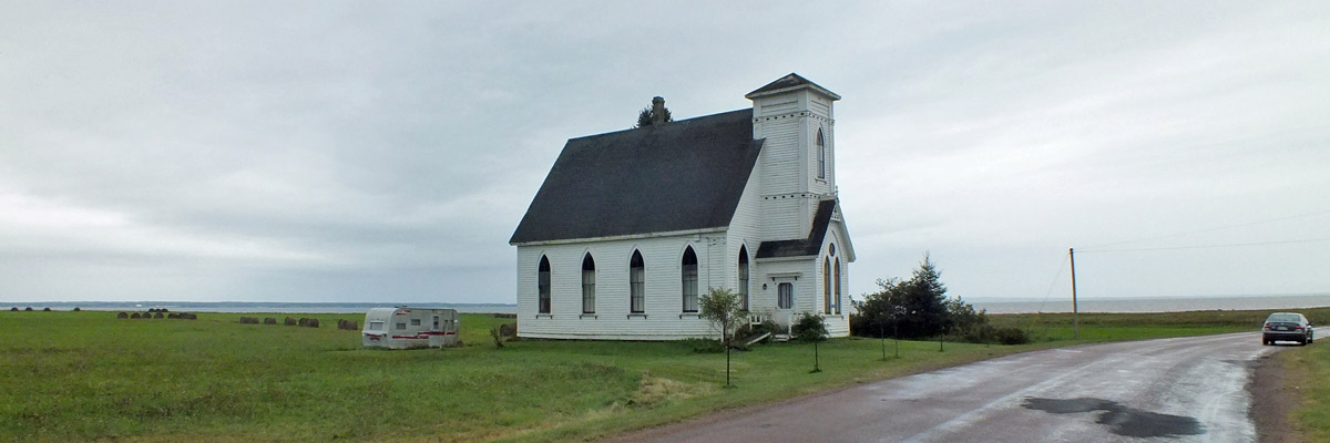 |
Upper Cape Baptist Church
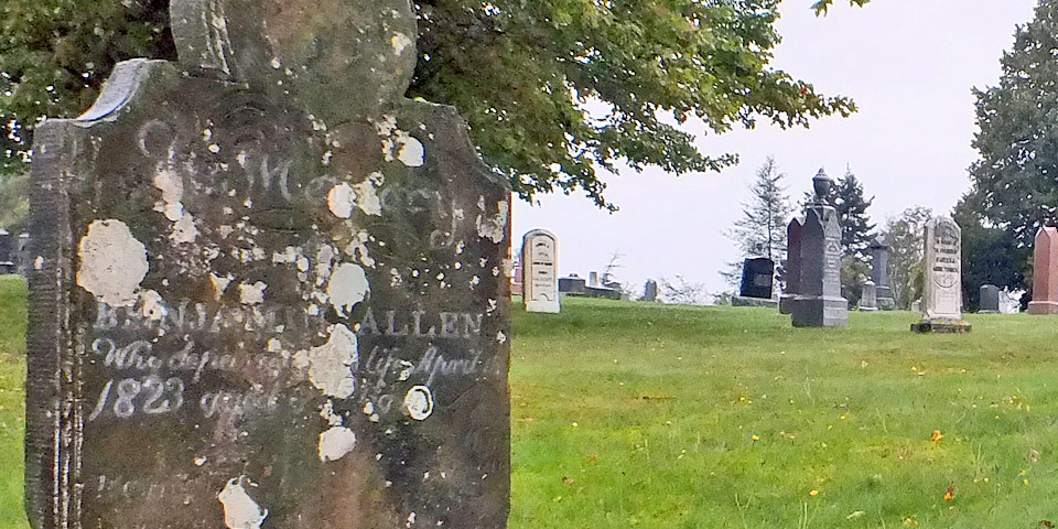 |
Benjamin Allen, 1735-1823
Today's Route
Next
| .August. | September | .October. |
| S | M | T | W | T | F | S |
| 24 | 25 | |||||
| 26 | 27 | 28 | 29 | 30 | 31 | 1 |
| 2 | 3 | 4 | 5 | 6 | 7 | 8 |
| 9 | 10 | 11 | 12 | |||
| 4 | 5 | 6 | ||||
| 7 | 8 | 9 | 10 | 11 | 12 | 13 |
| 14 | 15 | 16 | 17 | 18 | 19 | 20 |
| 21 | 22 | 23 | 24 | 25 | 26 | 27 |
| 28 | 29 | 30 |
The North Atlantic Arc Home
Mr Tattie Heid's Mileage
Results may vary
MrTattieHeid1954@gmail.com