
Nothing Like The Sun


17 April 2024
The North Atlantic Arc Home
| AprilApril | MayMayMayMay |
| S | M | T | W | T | F | S |
| 7 | 8 | 9 | 10 | 11 | 12 | 13 |
| 14 | 15 | 16 | 17 | 18 | 19 | 20 |
| 21 | 22 | 23 | 24 | 25 | 26 | 27 |
| 28 | 29 | 30 | 1 | 2 | 3 | 4 |
| 5 | 6 | 7 | 8 | 9 | 10 | 11 |
| 12 | 13 | 14 | 15 |

|
|
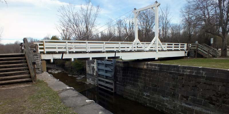
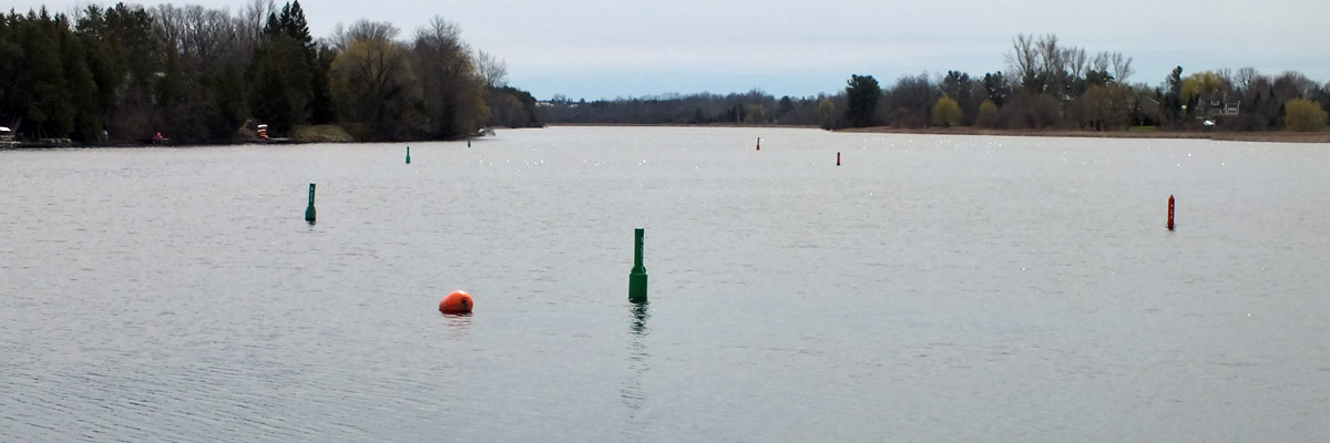
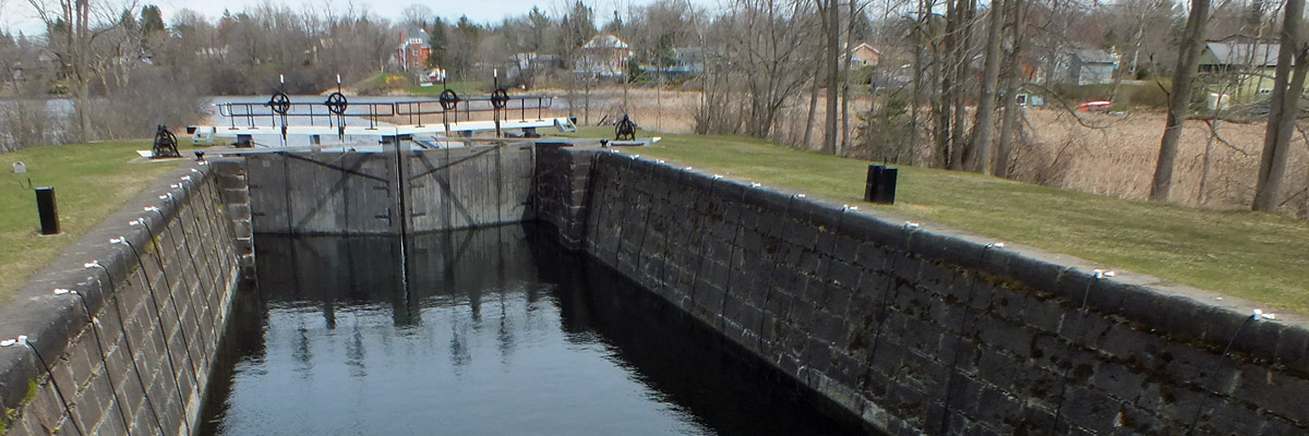
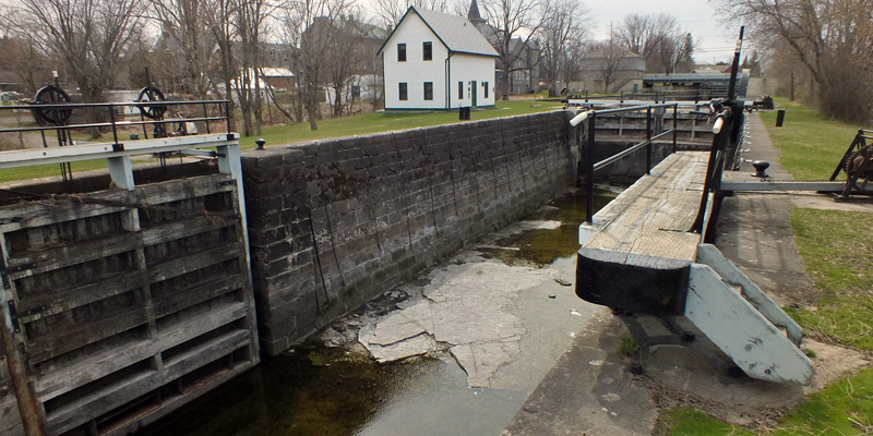
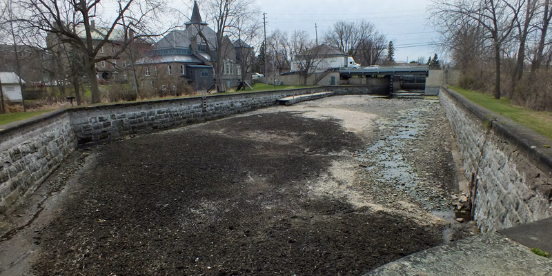
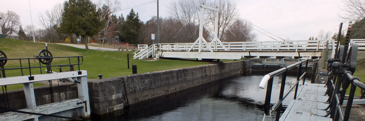
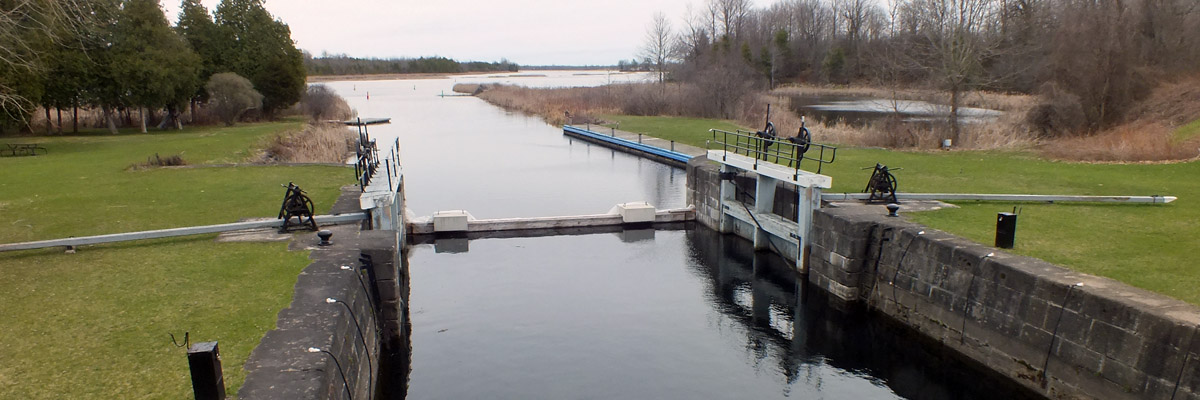
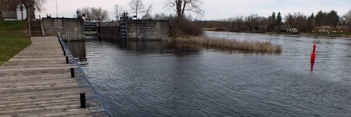
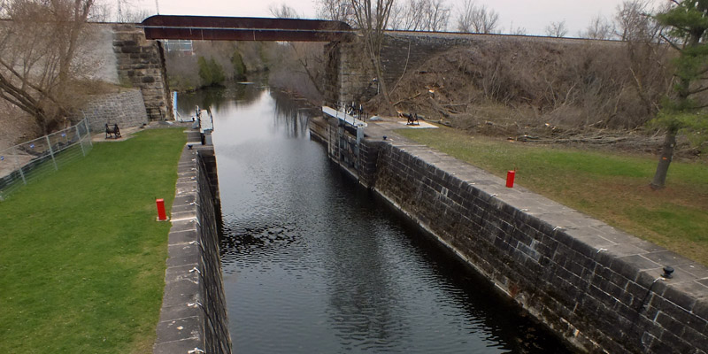
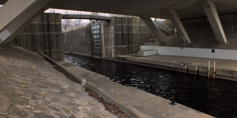
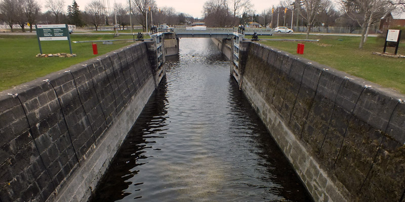
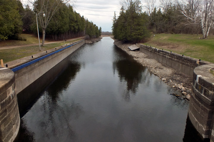
Wednesday 17 April 2024--I make the long backtrack this morning to the two locks, numbers 18 and 19, at Nicholsons. Guided by Samuel Clowes' survey, Colonel By planned to put a dam and a single lock at the foot of the rapids here, adjacent to the riverbed. He found, however, that Clowes' survey was in error, that the rise necessary was fifteen feet rather than ten, and the banks of the river were too low to allow for a practical dam. Instead, he put the dam at the head of the rapids, and made a half-mile canal cut bypassing the river, with two locks about a quarter mile apart. I walk along the canal cut, and then along the road to the old steel truss bridge that crosses the river. It was my intent to drive across this to get to the next lock site, which is just a little way upstream; but the bridge, built in about 1900, is closed. The village of Andrewsville stands on the other side. Once a busy place with three mills, a hotel, and a post office, it now holds fewer than a dozen houses. I see some posters around advocating for saving the bridge. The current structure could be made sound enough for foot traffic for not too much expense, but the value of spending several million dollars to build a replacement vehicle bridge is a subject of considerable debate. The snowmobile lobby has an opinion, as well. At the moment, there is no resolution in sight. All I know is I wish I'd gotten this far yesterday, so I wouldn't have to make a five-mile detour in one direction or the other to get to the next lock. The dam and lock, number 20, at Clowes are just a thousand feet from the dam at Nicholsons. The dam is one of a few overflow dams along the length of the canal. Colonel By had given up on overflow dams in most places, as erosion on the downflow side tended to undermine the works. Here, the riverbed was solid limestone, which also eliminated the need to build a masonry floor in the lock. Parts of the lock and dam were rebuilt around the turn of the twentieth century, but on the whole, the construction is pretty much unchanged after 190 years. Merrickville is another two miles upriver. It was my visit here in 2021, my first post-pandemic trip, that sparked my interest in the canal. As I noted then, the town grew up around a mill complex built by William Merrick, a Loyalist from my hometown of Springfield, Massachusetts, beginning in 1792. Colonel By found it convenient to buy out small mill properties along the canal, but that was not an option here. His initial plan was to build a flight of three locks in a snie opposite the mills. He realized, however, that this would force the full flow of the river into the mill channel, risking damage at spring flood. He concluded that the considerable expense of a canal cut would be more prudent than leaving the Crown open to possible financial damages. Instead of putting the locks, numbers 21-23, in a flight, he spaced them out, with basins between, to conform to the lay of the land. By's consideration was ill-repaid in August of 1831, when his intent to open the canal from Burritts Rapids to Ottawa was hindered by a lack of water, due to Merrick having dammed the river in order to make repairs to one of the mills. A frustrated By wrote to his superiors in Québec, suggesting that Merrick needed a good talking-to: "...if individuals are allowed to Control the waters of the Rideau Canal, the great expenditure that has already taken place will be rendered of little value; consequently it appears indispensably necessary that Mr Merrick should be written to on this subject and that law Officers of the Crown should be authorized to take such steps as will effectually prevent such interruptions in future." It's five miles by road to lock number 24 at Kilmarnock, but eight via the twisting river. The snie in which the lock was built cuts off a particularly sharp bend. Excavation pulled up a foul-smelling muck, which the crews blamed (incorrectly, I assume) for the malaria which dogged them. The lock was meant to have a lift of only four feet, but By reduced that to two to eliminate leakage into adjacent swampy areas, and compensated by deepening the navigation channel upstream. Lock 25 at Edmunds is four miles up the canal by water, eight by road. Here, as in some other locks, Colonel By installed a floor of wooden planks, which was cheaper and faster than a masonry floor. By noted that wood kept submerged was nearly as durable as stone. When the floors were replaced by concrete many years later, the wood was found to be still in good condition. Two more miles along, locks 26 and 27 are at Old Slys, named for early settler William Sly. By's problem here was repositioning the locks after the increase in size was approved, so that larger vessels could approach them in a straight line. And now I am in Smiths Falls, the largest town on the canal outside of Ottawa and Kingston, with a population approaching 10,000. The town was named for Thomas Smyth, a Loyalist who received the first land grant here, but never made much of it, and in fact never lived here. This was probably the most complicated site on the canal, and it's the one that has changed most over the years. The Rideau River drops 36 feet in a quarter mile, making this an ideal spot for the exploitation of water power. Despite this, there was only one mill when Colonel By arrived, which he bought out. The bulk of the drop was at Jason Island. By intended to dam the two channels around the island, and put a flight of three locks, with a total lift of 33 feet, 6 inches in a snie that cut through the middle of it. By realized that the depth of water above this would cause flooding of farmland, for which the government would be liable; so he reduced the lift to 25 feet, and built a fourth lock in a cut about a quarter mile upstream. He also moved the three locks, numbers 28-30, out of the snie, to the south channel, dammed the north channel, and put a waste weir in the snie. It's not clear to me whether the move had something to do with the reduction in lift, or was meant simply to provide a more straightforward passage for vessels. Smiths Falls grew quickly after the opening of the canal, and the construction of two railroads through town in the 1850s made it a major transportation nexus. The 20th century brought a modern road network. The swing bridge over the locks eventually became a bottleneck for both car and boat traffic. A plan to replace the locks and the bridge was argued over in the 1970s, complicated by the transfer of responsibility for the canal from the Department of Transport to the Department of Indian Affairs and Northern Development (and later to Parks Canada). Those who appreciated the historical value of the original locks were pitted against those who pushed modernization. A compromise was reached: a new lock, numbered 29a, with a lift of 26 feet, was built alongside the old flight, which was left in place. A new fixed low-level bridge replaced the swing bridge, and provided 26 feet of clearance below the lock. The north channel was filled in in the 1940s, attaching half of Jason Island to the mainland. The top few feet of the dam now serve as a retaining wall at the back of a parking lot. From the detached lock, number 31, there is a view of the permanently-open drawbridge, about a hundred yards away, on the long-disused Canadian Northern Railway line. Now the Smiths Falls Bascule Bridge National Historic Site, it is technically a Scherzer rolling lift bridge: instead of turning on an axle, it rolls on a track like a rocking chair. (Have a look at this view on Google Maps to get a better idea.) There is one lock left to see, at a site called Poonamalie. The name refers to a garrison town in India, but no one knows why it was applied here. Lock 32 sits in the middle of a mile-long cut that bypasses the first rapids below the Rideau Lakes, in a meandering part of the river. The lock is just a mile from lock 31 as the crow flies, but about two and a quarter via the canal, and four by road. It's an oddly quiet and isolated spot, amidst woodland and marsh.
It's been a long afternoon, but I'm happy to have completed my mission. I've seen thirty-two locks, plus 29a, at fourteen stations, to go with the seventeen locks I saw last year. I reward myself with a side trip to Perth for a pint at Bridge Masters Brewing, before making my way back to Westport. Next |
Locks 18-32
| Nicholsons |
 |
Lock 18
 |
Lock 18
 |
Lock 18
 |
Lock 19
 |
Lock 19
 |
Lock 19
 |
Andrewsville Bridge
 |
And On To...
| Clowes |
 |
Lock 20
 |
Lock 20
 |
Clowes Dam
 |
And On To...
| Merrickville |
 |
Approach From The North
 |
Lock 21
 |
Lock 21
 |
Lock 22 From Lock 21
 |
Lock 21
 |
Lock 22
 |
Lock 22
 |
Lock 21 From Lock 22
 |
Basin, Looking South
 |
Basin, Looking North
 |
Lock 23
 |
Merrickville Blockhouse
 |
And On To...
| Kilmarnock |
 |
Lock 24
 |
Lock 24
 |
Lock 24
 |
Lock 24
 |
And On To...
| Edmunds |
 |
Lock 25
 |
Lock 25
 |
Lock 25
 |
Lock 25
 |
Lock 25
 |
And On To...
| Old Slys |
 |
Lock 26
 |
Lock 27
 |
And On To...
| Smiths Falls |
 |
Lock 28
 |
Locks 30 & 29
 |
Lock 29a
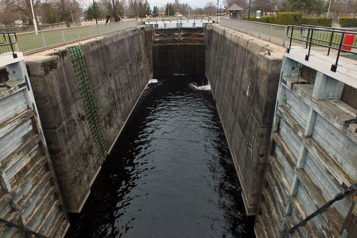 |
Lock 29a
 |
Lock 31
 |
Lock 31
 |
Scherzer Rolling-Lift Railway Bridge
...and on to...
| Poonamalie |
 |
Lock 32
 |
Lock 32
 |
Lock 32
 |
And On To Westport
Next
| AprilApril | MayMayMayMay |
| S | M | T | W | T | F | S |
| 7 | 8 | 9 | 10 | 11 | 12 | 13 |
| 14 | 15 | 16 | 17 | 18 | 19 | 20 |
| 21 | 22 | 23 | 24 | 25 | 26 | 27 |
| 28 | 29 | 30 | 1 | 2 | 3 | 4 |
| 5 | 6 | 7 | 8 | 9 | 10 | 11 |
| 12 | 13 | 14 | 15 |
The North Atlantic Arc Home

Mr Tattie Heid's Mileage
Results may vary
MrTattieHeid1954@gmail.com